Nothing like hiking 13+ miles only to come up 0.80 miles short of 100! Grrrrrr!
So despite the temperature being 94 degrees (but “feeling” like 104) I was bound and determine to put some miles in today. I probably ended up setting one of my best times today. I’ve decided my weekday hikes will be about improving my stamina and endurance. I don’t want to run trails or do “ultra-hikes”; but if I can push myself during the week, I think that will get me started in the right direction. Maybe its just my imagination, but my jeans seem to not be fitting as tightly…I hope!
Miles: 3:20
Time: 58:04
Min/Mi: 18:07
Everything I have read about the Ray Roberts Greenbelt trail mentions an overlook. I’ve seen the overlook from the bottom; but the question that I never could find an answer to is “exactly how do you get to the overlook”? It seemed like it’s some well-kept secret. Well, for better or for worse, I’m about to expose the truth!
There is an overlook…and I have found how to get to it…but I’m going to make you suffer through the usual recanting of the day.
My intent was to hike the Equestrian Trail; however we had a pretty big rain event earlier in the week and they had that trail chained off. Not to be one who is easily deterred, I went around the chain and headed up the trail. First, one foot sunk, and then the other…I looked up.
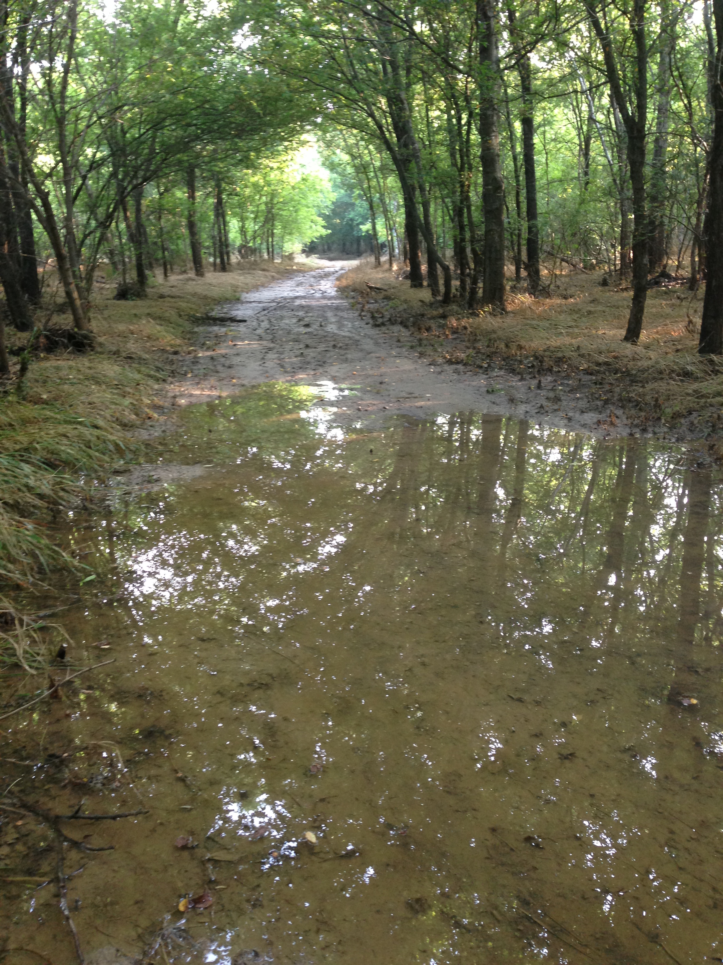
Water Logged
Yeah…no. So I headed back to the original hike/bike trail.
About two and a half miles in, at the sign telling you have about 3.85 miles to FM423, there looked to be another turn off that connects the hike/bike trail back to the Equestrian Trail. I figured maybe that first section was sloppy and it gets better. It didn’t get better.
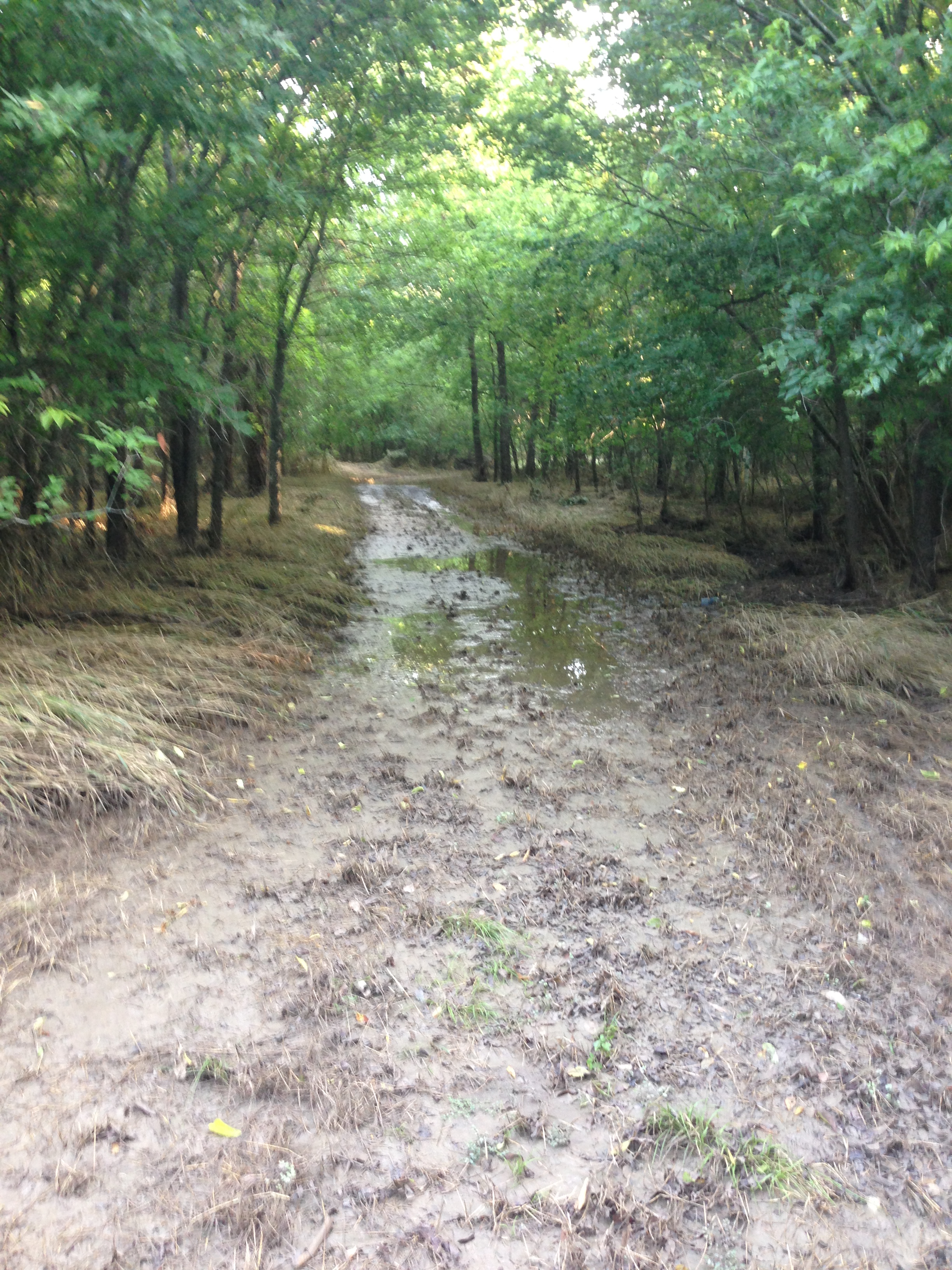
…really…I just need to stop.
While I did see a ton of interesting tracks, my tracks were slowly becoming a disaster after I tried about 100 feet of this slog.

I’ll never be allowed in the house like this.
I resigned myself to the fact that I would have to keep to the regular trail and my dreams of hiking the Equestrian Trail will have to wait. However, I wasn’t disappointed.

this looked like two deers fighting with antlers
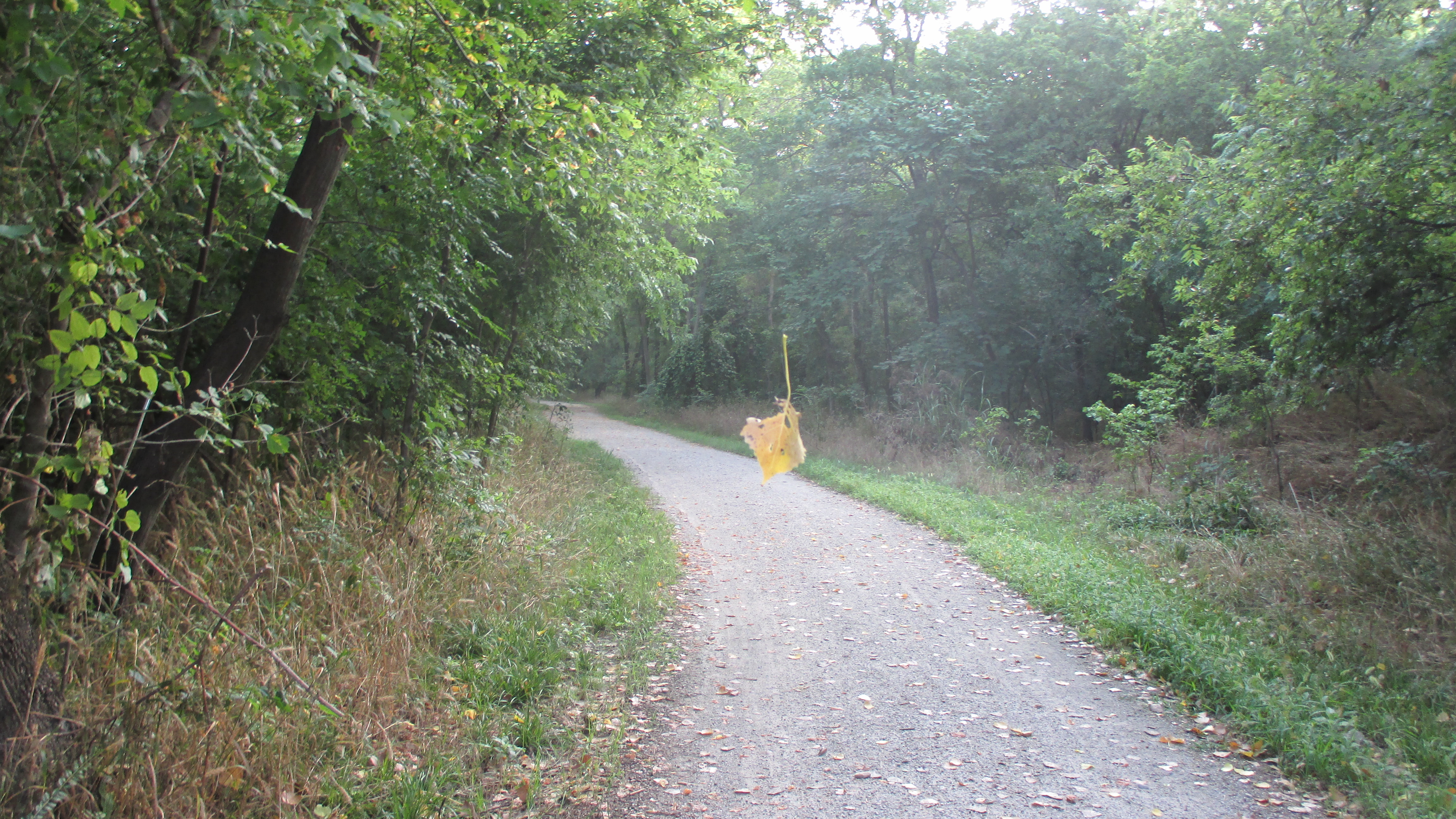
magical leaf floating in thin air
I finally approached the next sign alerting me to the upcoming FM 423.
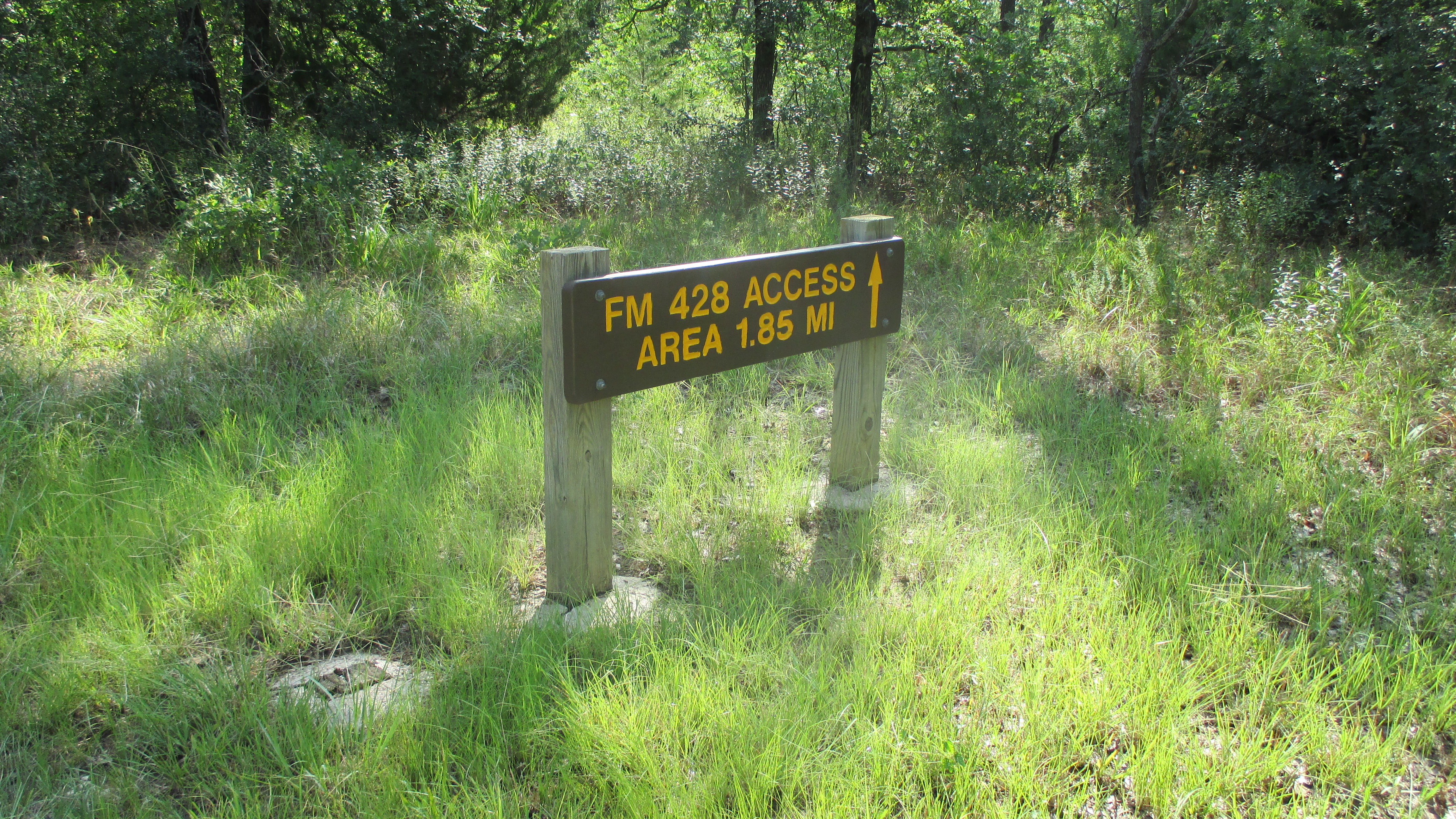
FM 423
About 20 paces past this sign, you come to a fork in the trail, with a red dirt trail going off to your right toward the east. What the hell….the last two trips were a disaster with the soggy conditions, let’s try it again.
I turned right and started heading east. The trail was a little dryer; still wet, but not as bad as the ponds. I came up to this sign.
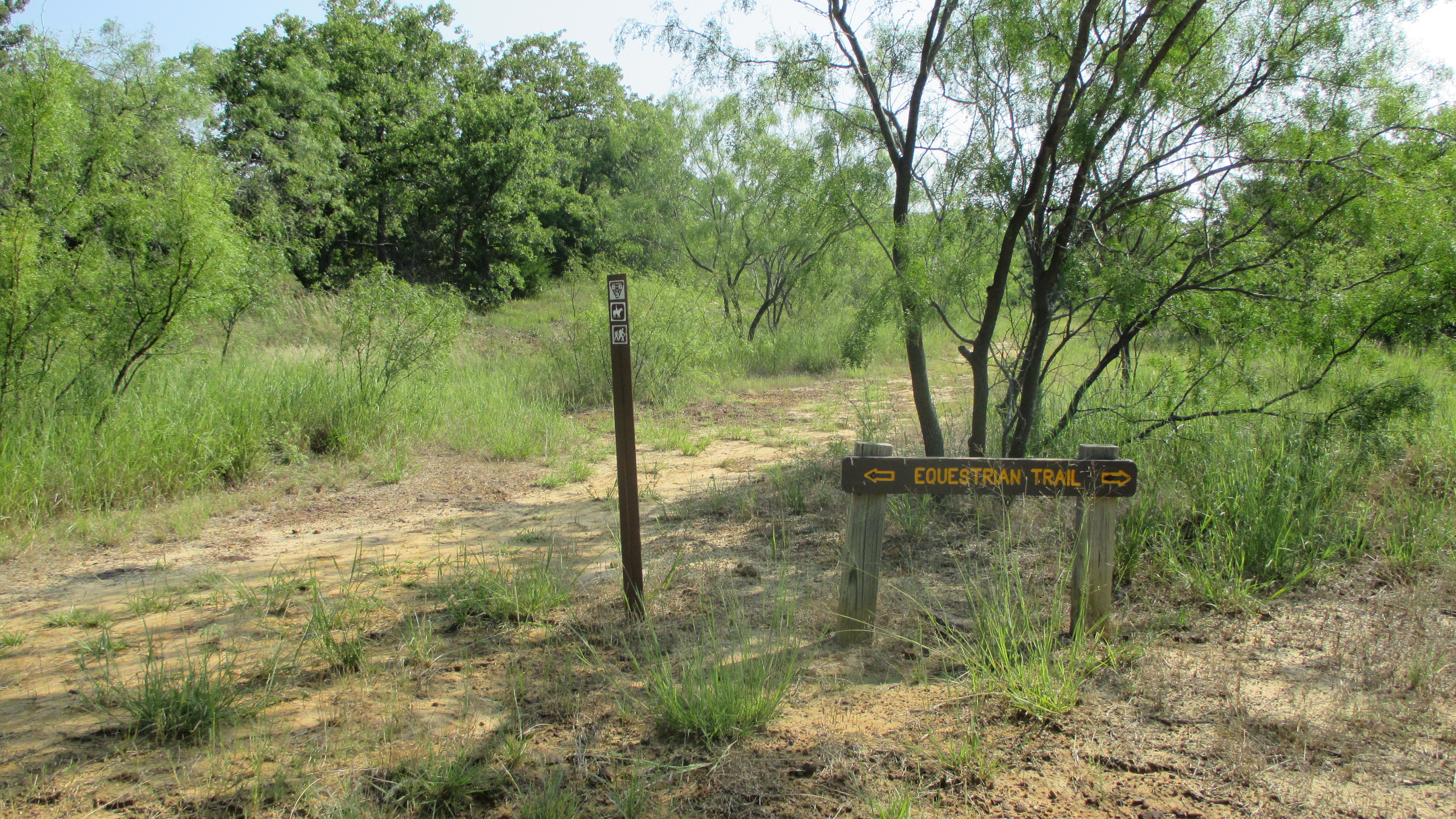
Equestrian Trail
You can faintly see a trail to the left of this sign…so I decided to go for it.
Road less traveled
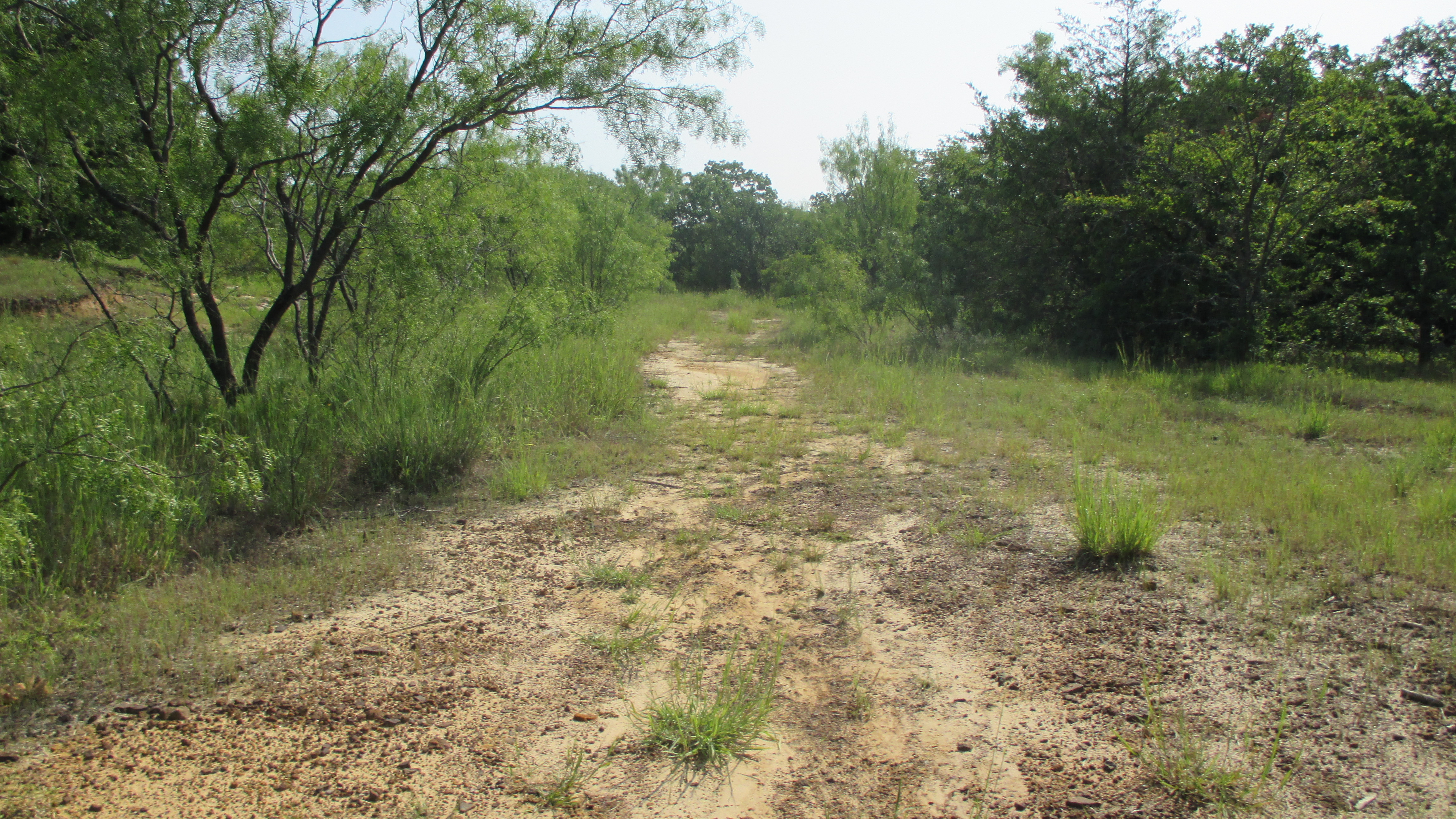
The trail heads east for a bit and slowly turns north and up. North and up is a good direction. There were a few places where you think you may have lost the trail, but looking ahead I could see what looked like a trail. At the top of the trail I met this girl and her herd.
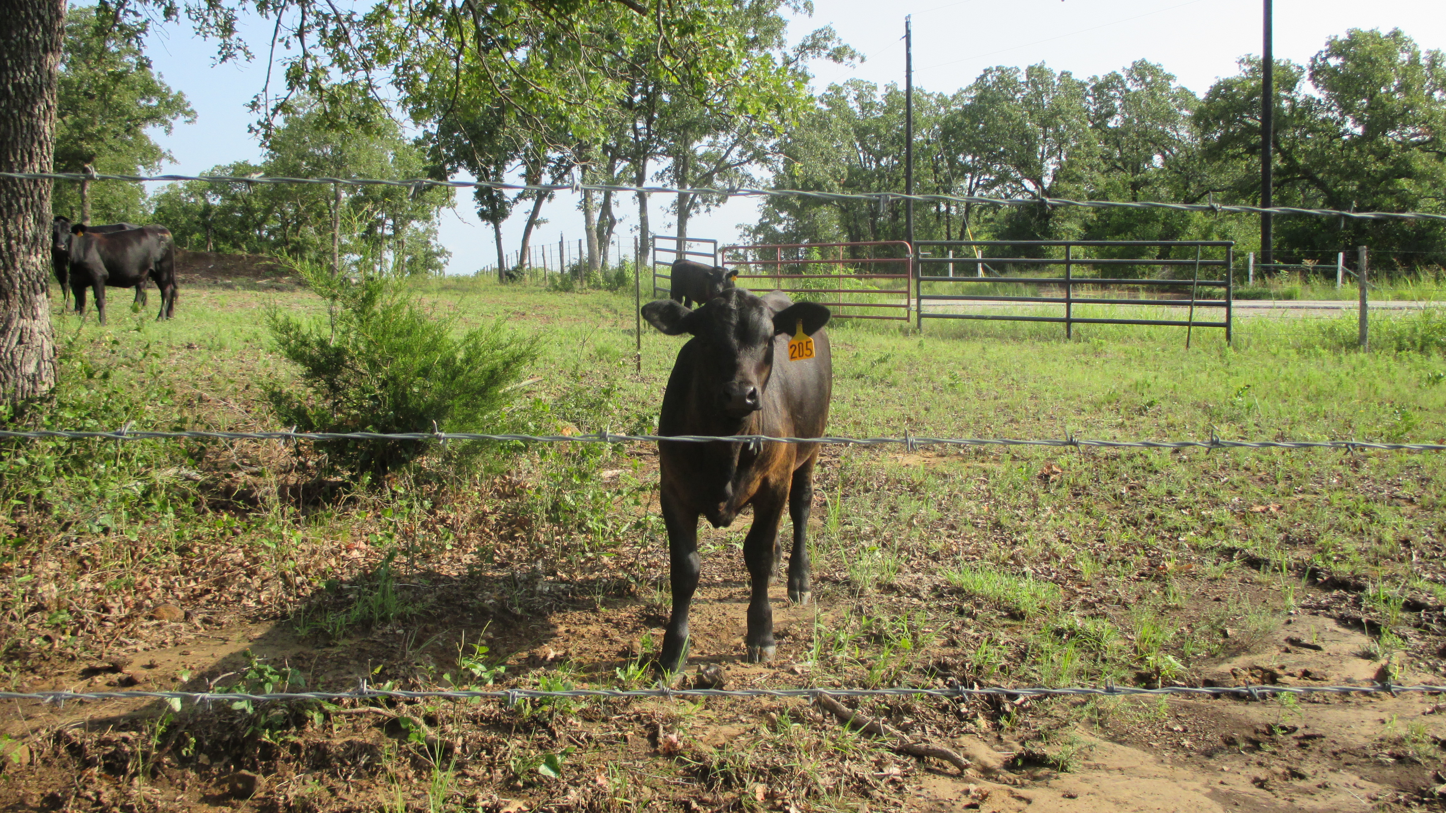
You lookin’ at me?
This is where the trail ended…or so it seemed. I looked to my right. That headed down and I wanted to go up. I looked to my left and amongst the tall grass I could see a faint trail….the trail now headed west, but at least it was heading up and there looked to be a sign post that direction. So up it was. And what was on the signpost? Well…a sign of course!
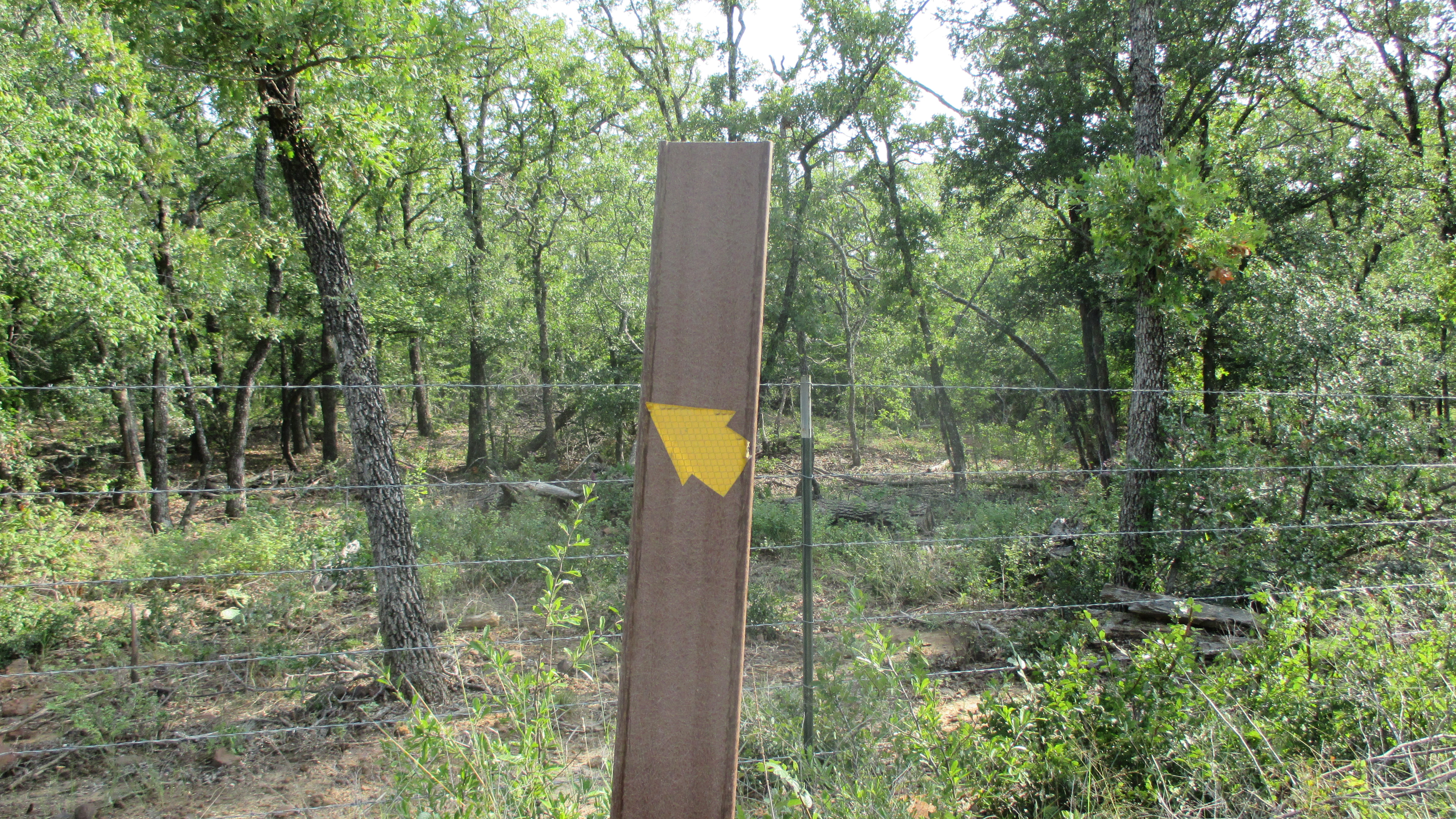
This looks promising
This is what it was pointing to…you can see a faint trail that heads west and up, but then turns north at the corner of the cow pen.
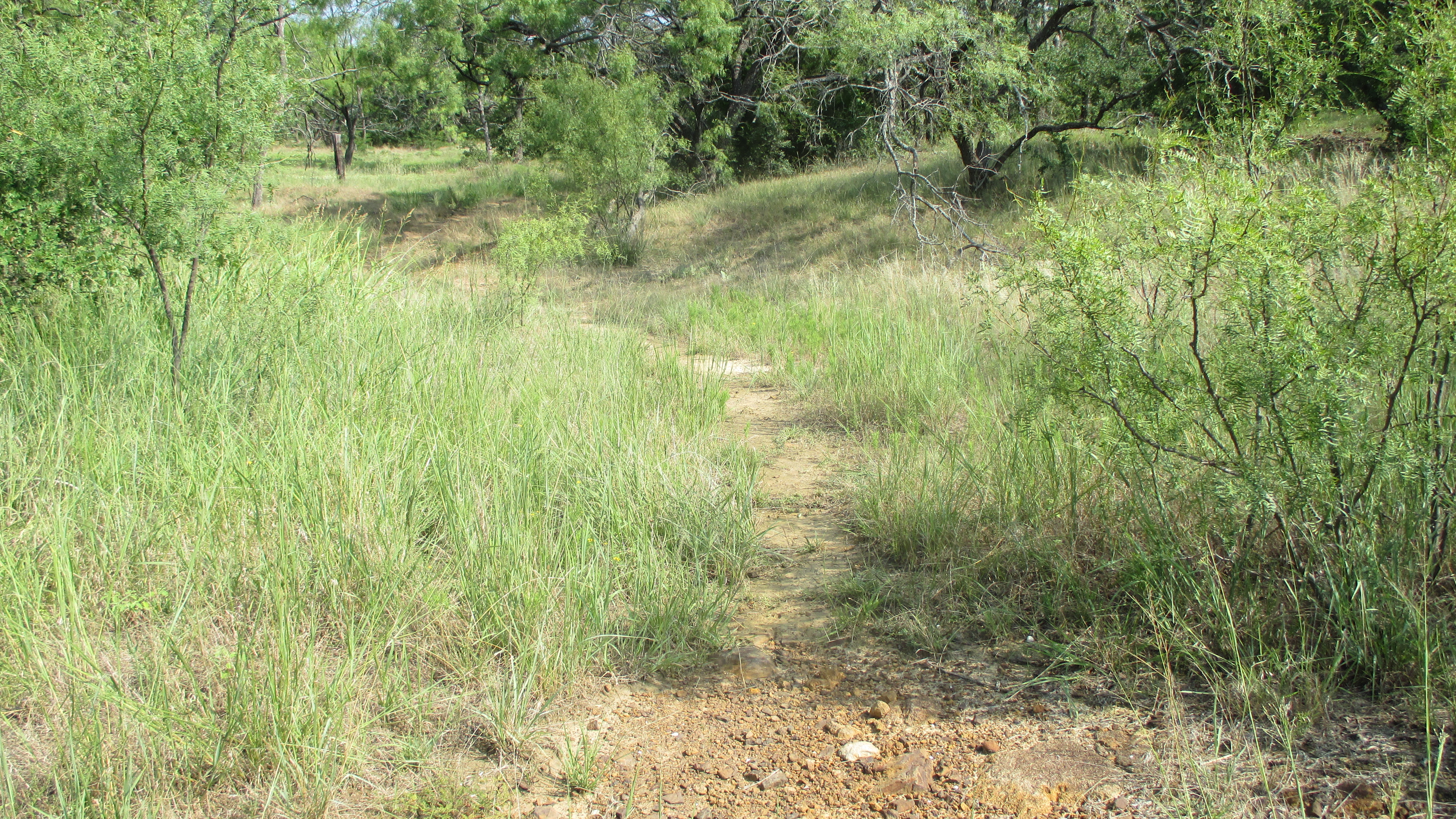
Scenic overlook trail?
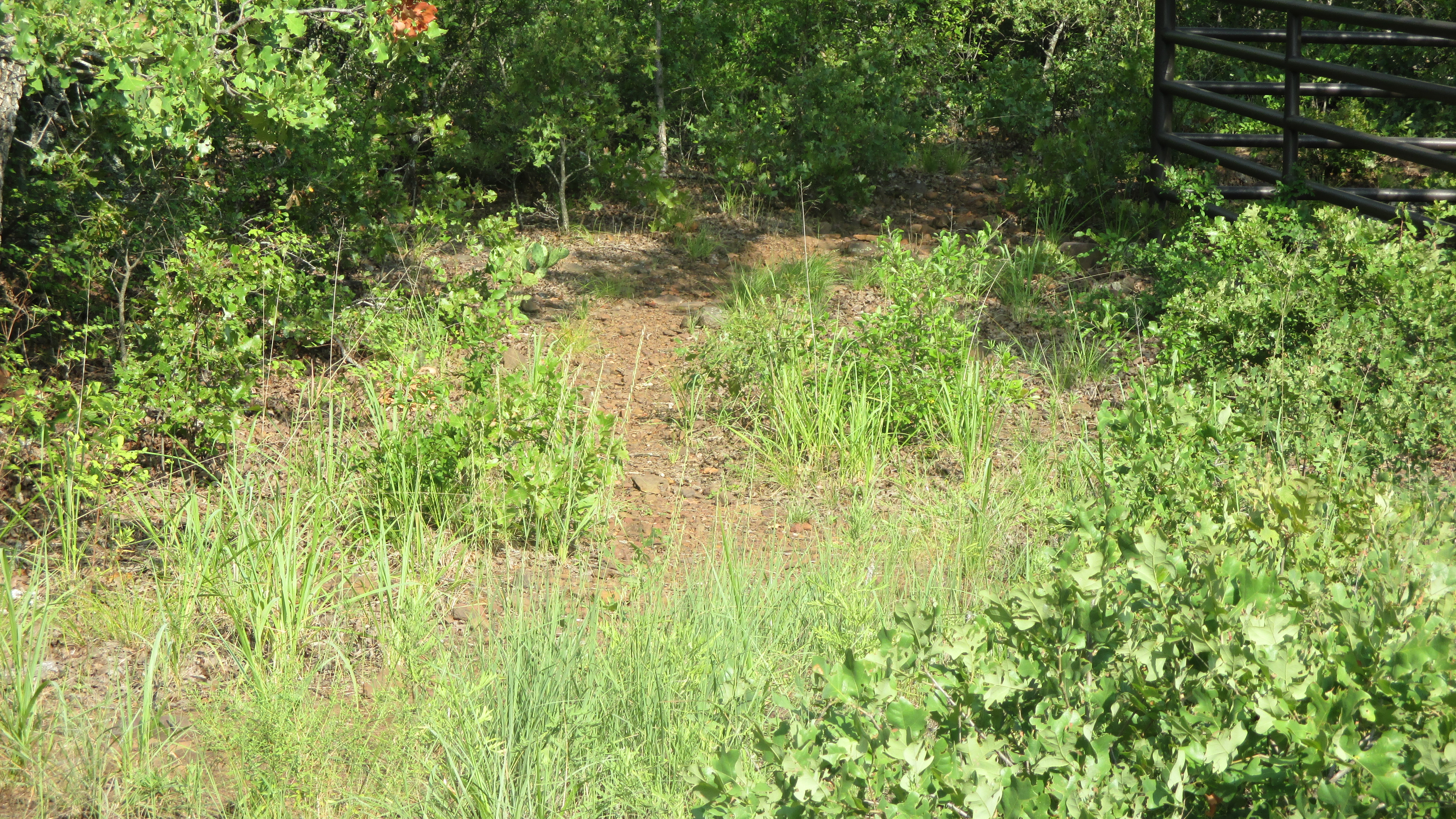
One you get to the corner of the property, it turns north…but then starts going down a ways. It’s really deceptive. I figured I’d gotten this far, lets take it as far as I could go. About 150 feet the trail starts turning back to the west and going up. Bingo! I was not disappointed! I had found the overlook.
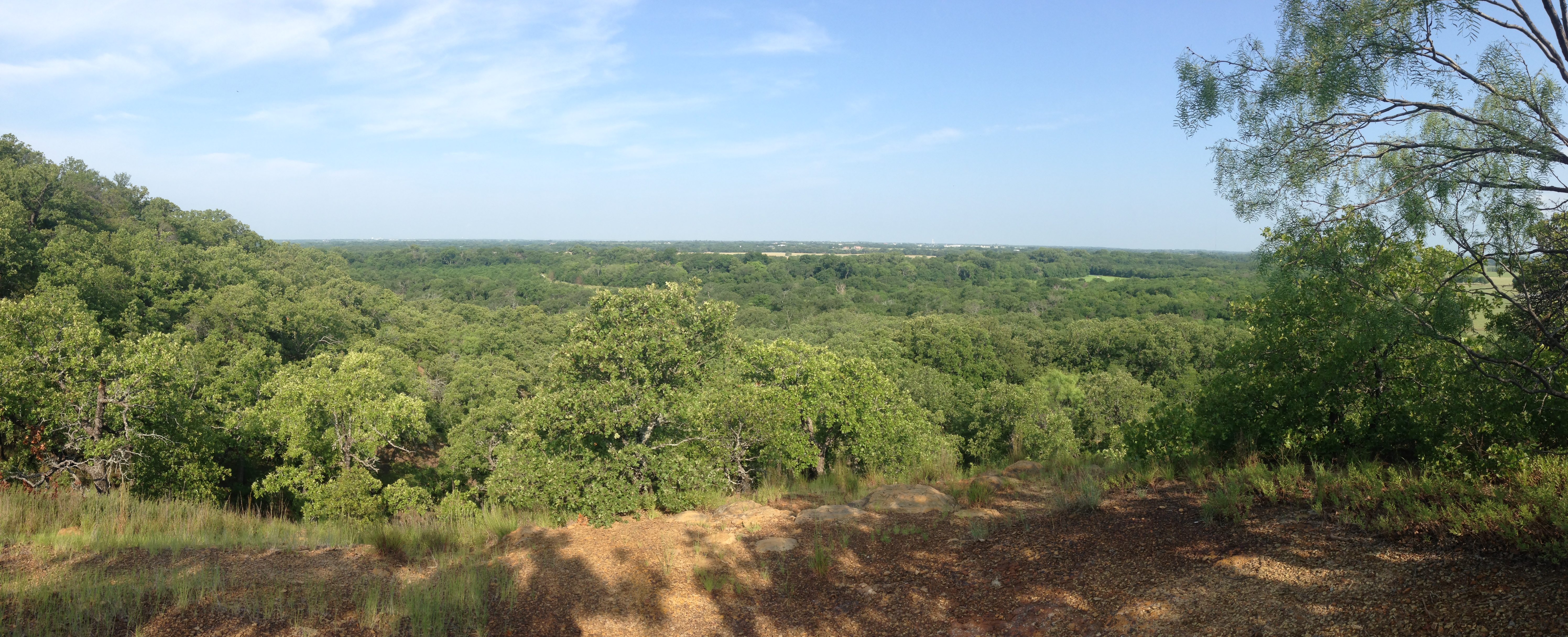
Scenic overlook
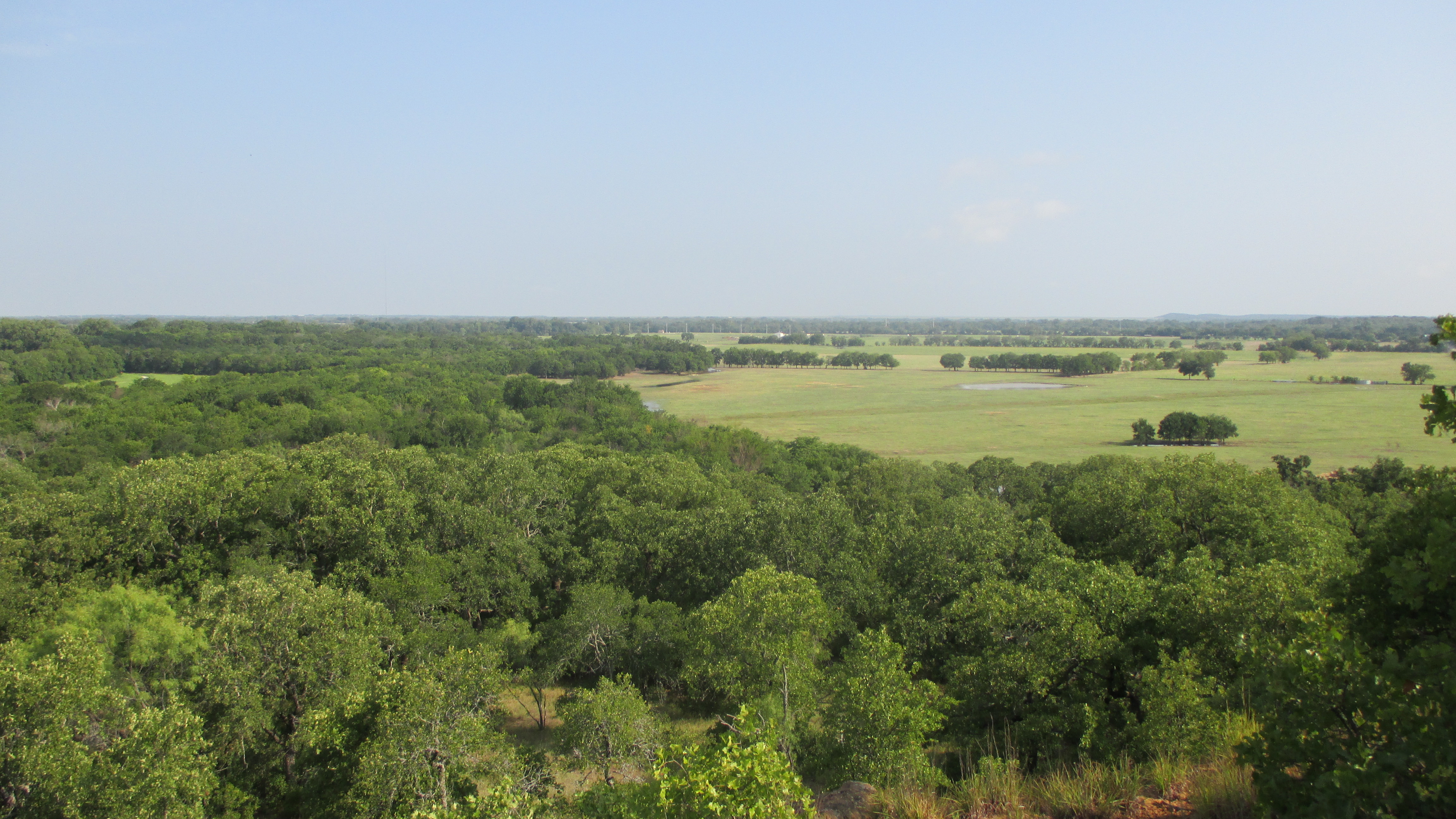
Pasture meet forest
It was really quite amazing up there. I sat, had a bite to eat and drank my water. I could have stayed there a lot longer, but figured I’d needed to head back down. Now from the overlook I found at least two trails directly from the overlook that seemed like they led somewhere, but if they did, I never could see the trail. At this point, I had tracked and back tracked enough and I was convinced that poison oak or ivy was about to be in my future.
I decided to backtrack back to the sign post with the yellow arrow. Instead of following the trail back down the cow pasture, I was able to see a new path that actually led up to the spot I was standing. I decided to follow this trail, and it was indeed a very well marked trail heading back down the hill.
I finally came back out at the very Equestrian Trail sign where I took the first trail up. Except this trail is about 10 paces to the left of the Equestrian Trail sign….
Seriously, how did I miss this?
Anyway…that’s how you get to the scenic overlook…you have two options. I sort of liked my way….nothing like coming face to face with black Angus on the trail!
Back at the original trail, I knew I was little under 2 miles from restrooms. After traipsing in mud, and tracking and backtracking, the thought of squatting in the woods just to invite more poison “oak/ivory” was not my idea of a good time. Screw it…we’re heading to bathrooms.
A quick break and I started back to the trail head. All in all a really good day. I found the overlook, so I can knock that off my list. I still want to hike the Equestrian Trail…it looks like it would be a great challenge! Luckily I have long hiking pants and long sleeve shirts for that hike as I suspect I’ll be doing a bit of bushwhacking.
Now…before we get to the tape…let me share with you my disappointment. I had hoped to reach 100 miles on this trip. But I came up 0.80 miles short. Seriously? Crap…. Ah well…the overlook was the crown jewel of the day!
Miles: 13.93
Time: 05:25:29
Min/Mil: 23:22
Luckily I have friends in real life who actually read this and drop me tidbits about hidden gems. This is one of those. My thanks go out to my Work Husband – JP who turned me onto this area!
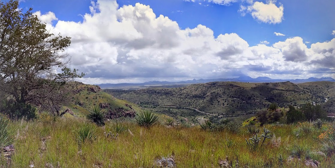
Who knew that just north of Dallas, is nearly 1500 acres of remaining green! This is all part of Lake Ray Roberts State Park, but man was it worth checking out!
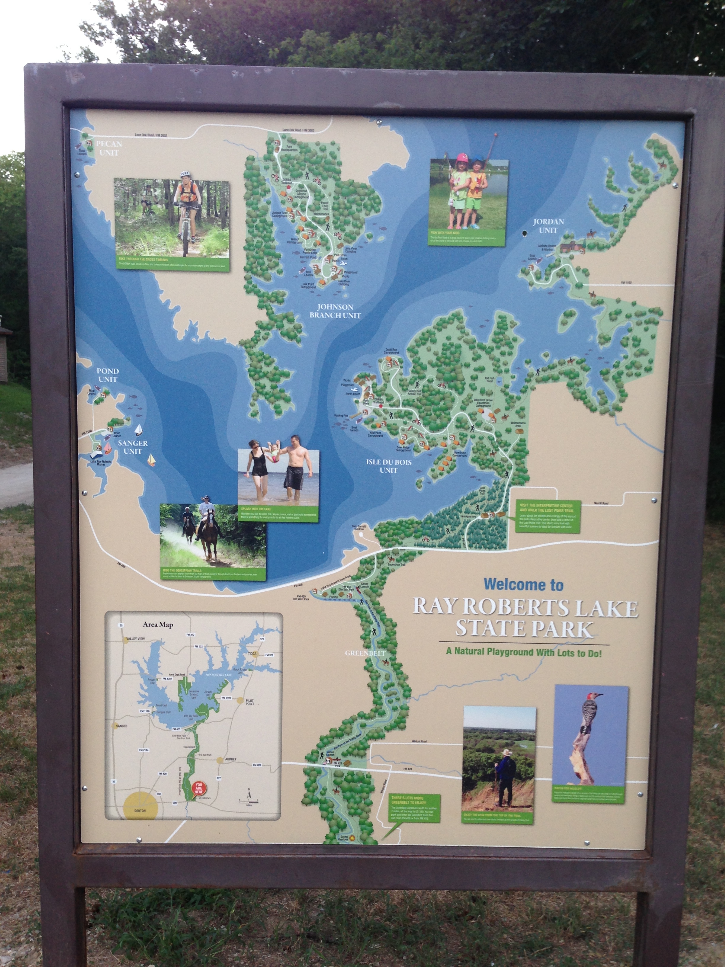
Ray Roberts Lake State Park
First…let’s talk directions. If you’re heading north on the Dallas North Tollway, go like you’re going to southern Oklahoma and turn left on Hwy. 380. You’ll effectively be heading into Denton. You’ll pass a ton of stuff such as the Savannah Resort Living Community that looks like it could be the backdrop of your favorite Stepford Wives movie. You’ll eventually see the turn off for Hwy. 377 North to Pilot Point….do not take 377; but instead know that about 2.06 miles later, on your right you’ll see a sign for “Greenbelt Corridor”. You’ll find a parking lot here and some restrooms but that’s it. You’re going to need to pack in plenty of water for this hike as there are no water sources on the trail. Yes…it follows the East Fork of the Trinity…but do you really want to drink that? I didn’t think so.
Anyway…once you park, you pays your money. It’s $7.00. Quick whining…it’s damn well worth it. It’s better than the crappy 6 pack of beer you bought last night…so you will pay your money and you will like it!
As for me…well…I had read it was $3.00…took $5.00 and then felt guilty as I filled out the “honor form” and promised I’d pay more next week for being a dolt. Hopefully someone got a laugh out of that. I did today sign up for the Texas State Parks Pass…so at least I followed through there.
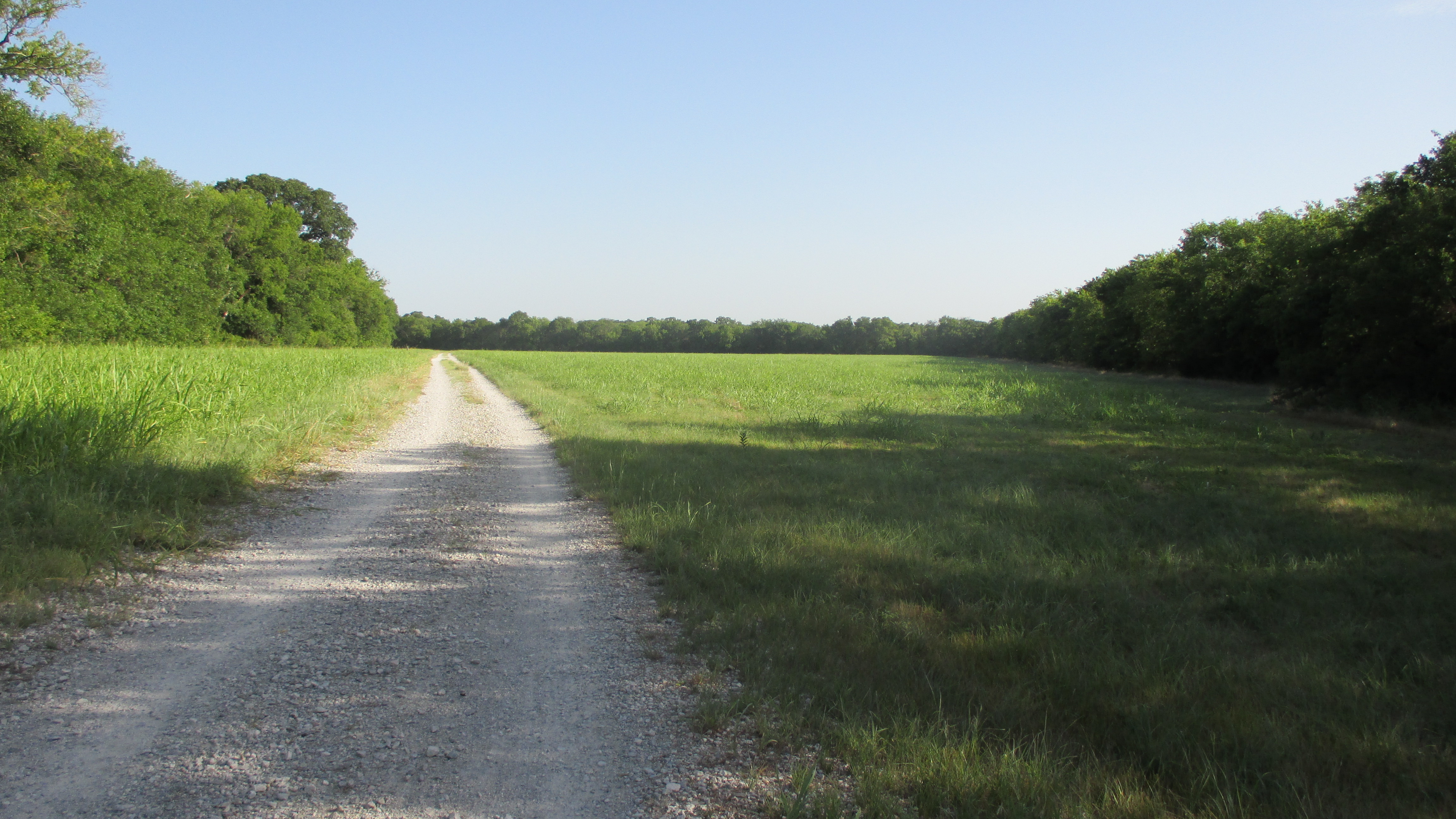
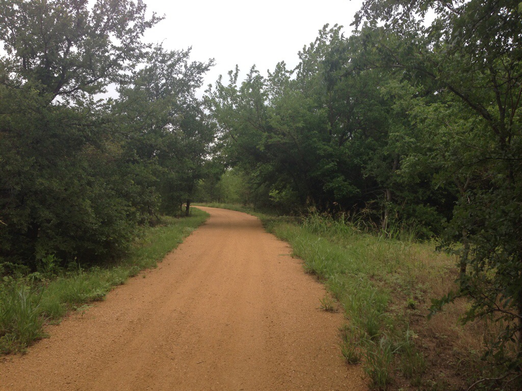
You have two options of trails. One is a caliche trail which all the hikers, runners and bikers use and you have the equestrian trail. I decided to stick with the caliche since I needed to get a lay of the land and this was my first hike and all.
I grabbed my day pack and got everything situated. The hike between 380 and the FM 428 is about 6.5 miles…one way. So little over 12 miles if you do an out and back and that’s what I had my heart set on doing. I started just a little before 7:00am. I made sure to carry about 3 liters of water (damn water is heavy) and an extra bottle of Ozarka for when I stopped for lunch. And we’re off!

Tranquility…
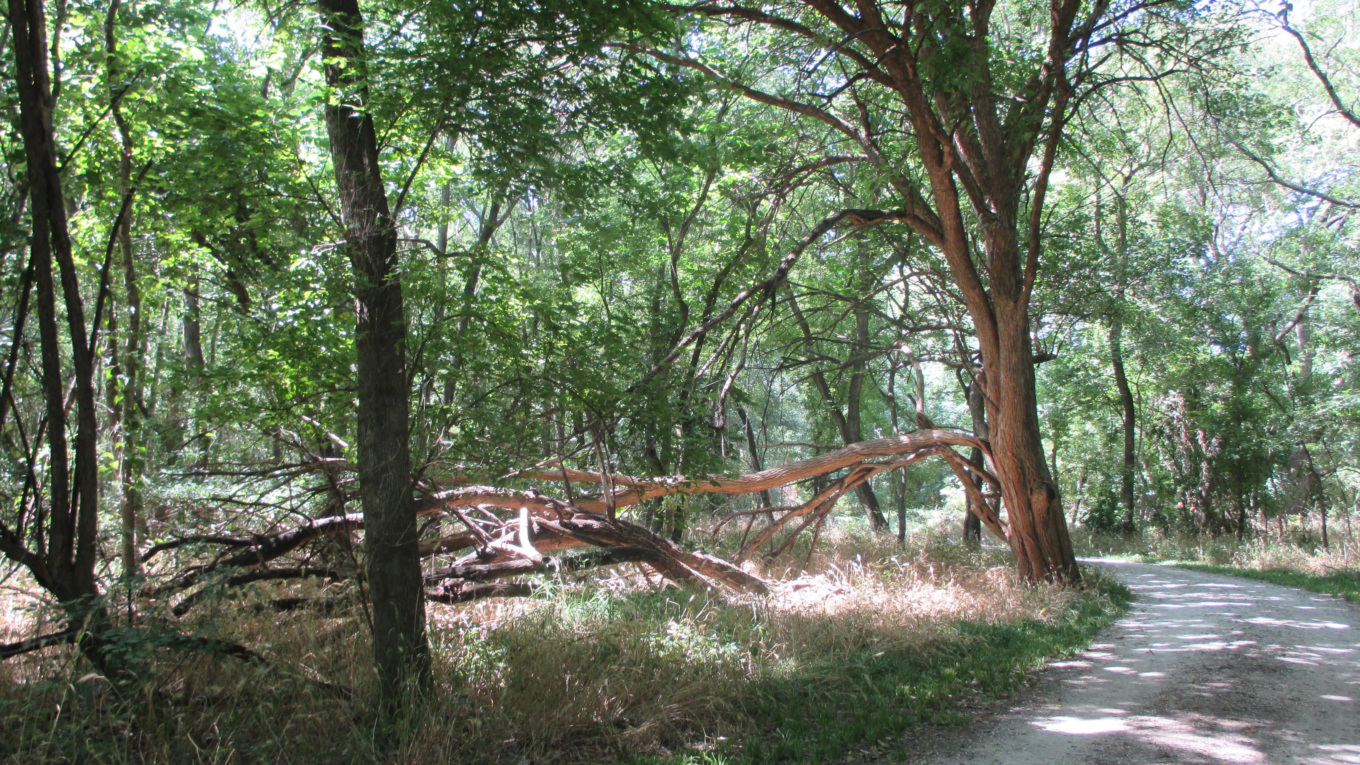
I was not disappointed. This is old growth. There are trees here that are so big around, I cannot get my arms around them! The woods are dense, yet alive with all manner of tree frogs and birds as the day was getting started. I can’t tell you how long it’s been since I’ve heard tree frogs like that!
This was the start of the hike…seriously…it just got better from here!
You cross a couple of utility right of ways…the first one for electric and the second one is rail road. I can only imagine what it must sound like to stand under that trestle when the train is going over.
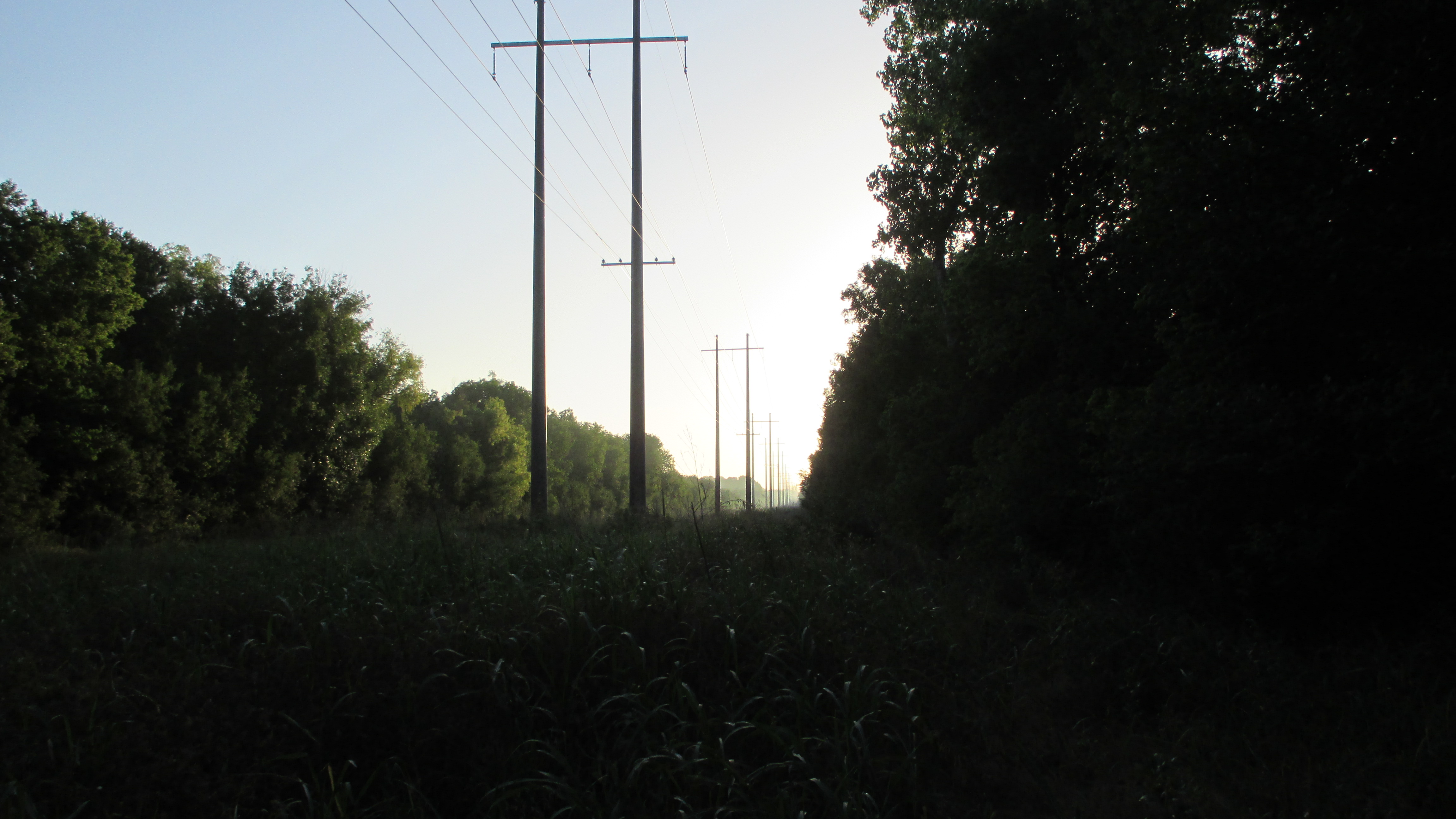
Utility Right of Way
The path is pretty easy it’s just really long. As I’ve mentioned in previous posts, I don’t listen to music or use ear buds when I’m hiking. There’s too much stuff you miss out on doing that.
For instance, as I was walking, I heard an odd crack of a branch. I stopped and about 100 yards off I saw a young buck just starting to get in his antlers move through the woods….he stopped for a minute and continued on closely followed by a doe. I realized as I had stopped that while I had put on sunscreen, I had failed to douse myself with inset repellent and the mosquitoes were looking for breakfast and I was prime candidate #1. So I took off my pack and sprayed myself down. I was hoping I would out walk them the rest of the way!
A little further something in my “wilderness” sense told me to stop. Glad I did. I was greeted by a deer and her fawn. The deer stood and stared at me a bit. She was about 20 yards from me…she then slowly turned around and continued on her way, very much unconcerned with me. That’s when her fawn wanted to come up and take a look at me and see what all the fuss was about!
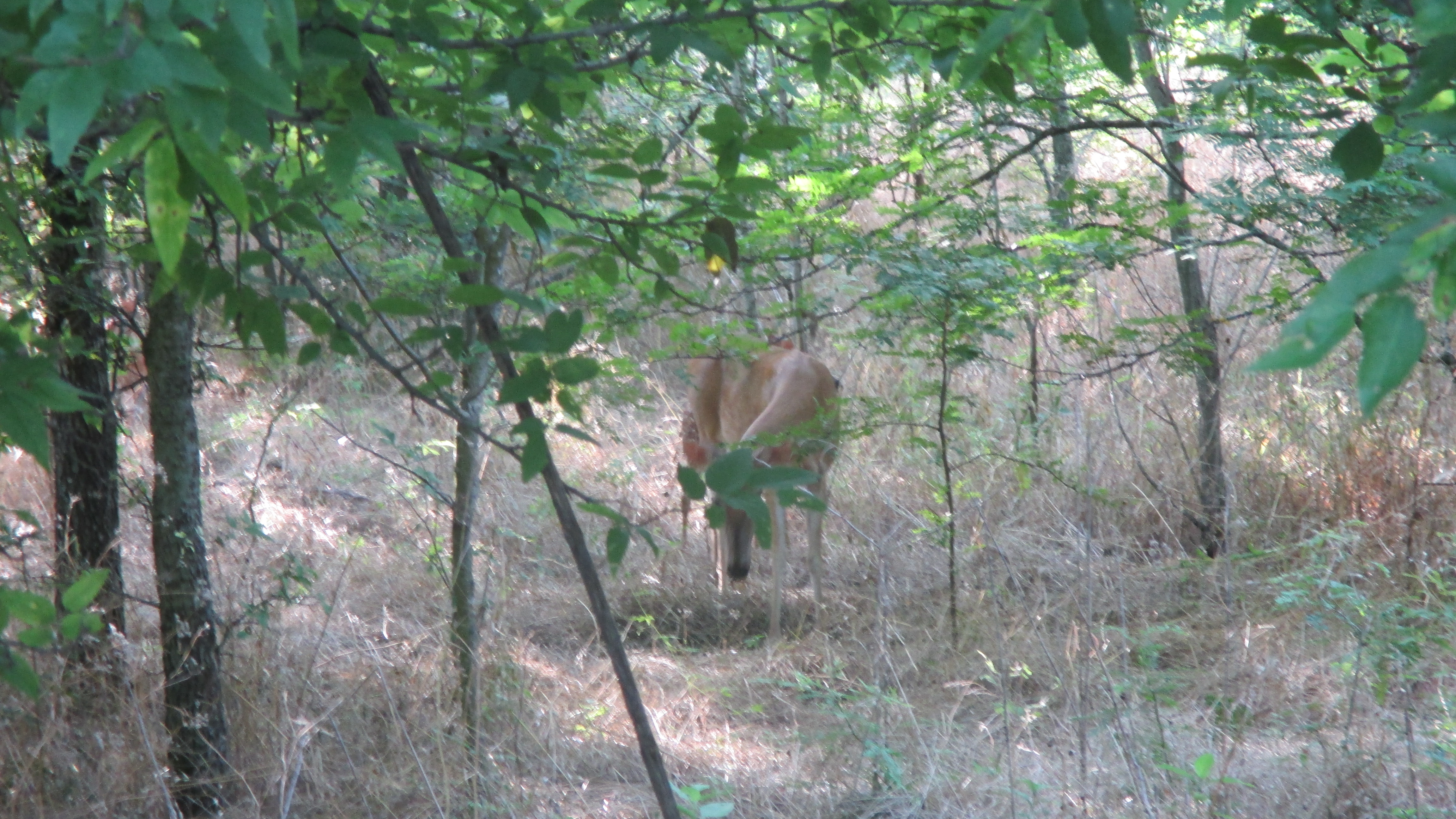
Momma

Baby
Probably one of the best site’s I have found that runs through all the different points on the trail is the one at Trail Map of Greenbelt Corridor in Ray Roberts Lake State Park.
I finally arrived at the Ray Roberts Lake State Park there off of FM 428. They have great modern restrooms, drinking fountains, and plenty of picnic tables to sit and rest. I had my lunch glad that I had brought a bottle of Ozarka vs. having to sip water from my hydration pack. When you’re thirsty like that you just want to guzzle. I took about a 30 minute break and started on my way back. I decided to start back on the equestrian trail. Not sure why…there were TONS of grasshoppers everywhere bouncing off of me…not to mention I was walking through a patch of recently mowed Johnson grass. As I got to the first tree line I startled another deer. But this time she had two fawns that she rustled up out of the grass and had them follower her deeper into the woods away from the stranger who had suddenly disrupted their late morning siesta! I decided then and there that the next time I hike this trail (which will be this weekend) I think I’m going to hike the equestrian trail. During the hike I saw a hill that must have really great views of the area. Every map I saw talked about the “scenic overlook” but I’ll be damned if I ever saw the path for it. However, upon further inspection I realized I could easily get to it via the equestrian trail.
Other than that I saw the usual woodpeckers and cardinals. I got a quick glimpse of a blue bird and a really big lizard up on a tree. Tons of dragon flies of all ages.
I finally got back to 380 around 11:45AM. This time I didn’t pause Runkeeper every time I stopped. I wasn’t really worried about pace…I really wanted to experience this trail and enjoy this hidden treasure. Here’s some pictures from the hike and of course the numbers!
Miles: 12.46
Time: 4:16:34
Min/Mil: 20:37

First Bridge

Scenic Overlook….from the bottom
Meadow
And finally…probably my favorite picture…I love the sun coming through the tree canopy!
Tree Canopy
So yeah…about Saturday being my day to do long hikes…that’s change. We’re now moving those to Sunday for a number of reasons:
1. On Sunday, everyone is at church. Less traffic on the trail!
2. Nature is my “church” so it makes total sense for me to be outside.
3. NCAA College football is on Saturdays…this is important. I could care a less about the NFL; but I’ll be damned if I’m going to be away from a TV for any length of time when football season begins!
4. My partner finishes up her master degree in two weeks. You know what that means? My days of not working on projects comes to an end. She will become the “task master” again and my Saturday’s will be filled with projects. This is bad…she’s even got a project management tool that she’s been using to list out projects and the tasks associated with those projects. As you can see, the “honey do list” isn’t just an abomination heaped upon guys…it happens in every relationship!
5. Last, but certainly not least, Sunday’s was my slack day anyway…so what better way to spend it than to lay down a 10 mile hike, come home, and sleep the rest of the day!
So…since this is Saturday I’ll be running errands….however stay tuned for tomorrow’s post! I’ll be checking out a new hiking spot and will post a review and pics here.
When I can’t think of a title I resort to dates. I know. It’s lame.
I guess I owe a bit of a catch up.
Currently I’m up to 66 miles total since starting this in June. My feet hurt, my body hurts….but on the plus side…I’ve got one hell of a tan working at the moment. Stop. I don’t even want to hear about how this is going to cause me skin cancer when I get old. I’m using SPF 50. I think I could only do better if I basically covered myself in a burka and that ain’t happening. Number one it’s hot. Number two, this is Texas. Someone will shoot me.
I am happy to report that someone apparently does, from time to time, read this blog. One of my co-workers came up to me yesterday and turned me on to some new hikes in the area! I’ve very stoked and excited. No I’m not sharing right now. I have to give you some reason to come back now don’t I?
I do need to add a page to this blog with the hikes I’ve done. I also need to get better about describing the hike in better detail. The problem is when I’m on the trail, I’m very witty. Trust me. The problem is when I get home and decompress and I can’t remember shit I was thinking about on the trail.
I am happy to report my boots are holding up quite well. The Body Glide stuff I’m using for chafing is doing well…except for today. I have a new blister on a toe that hasn’t been there before. I’m blaming it on the fact that I had to wear wool synthetic socks since all of my Thorlo socks are in the dirty hamper. Which brings me to a new system we’re starting at our house.
My partner already has to laundry baskets where I have to separate everything. No single pile for us… We have the Whites/Jeans (whites being the “unmentionables”) and we have “Everything Else”.
We’re going to add a third hamper for “V’s Stinky Hiking Crap”. You see…I’m an odd bird. I’ll wear the same hiking stuff day after day. I don’t wear it in “public” or to work or anything. But the way I figure it, why throw clothes in the hamper when all I’m going to do is put on a clean pair of clothes and trash the hell out of them by hiking in 95+ degree weather sweating like a pig! I usually peel the stuff off…lay it out somewhere and let it dry for the next day. Never mind that the cat likes to lay on this stuff and then jump on my partner’s side of the bed and roll around.
However, today, I realized I may be taking this a bit too far and that this Texas weather may be more than the clothes can handle. I was midway through my hike this evening when I stopped to take a drink and rest in what little shade that exists. I kept smelling something funky. Like maybe a sewer had backed up or something….when I suddenly realized that maybe it was me I was smelling! Hence I came home with the epiphany that maybe my hiking clothes need their own hamper to keep them separated from the general population!
Other than that, I noticed my hiking pole is starting to wear down. This is not one of those fancy ones where you can stroll into REI (aka: Really Expense, Inc.) and buy replacement tips. Nope…these are what they are. The good news is we have three others that I’ll eventually wear down; but if I ever do a real hike, I’m probably going to have to break down and buy new treads.
Let’s have a look at the tape for the last two days (since I was a slacker and didn’t blog yesterday):
July 8, 2014
Miles: 4.39
Time: 01:24:45
Min/Mi: 19:19
July 9, 2014
Miles: 3:17
Time: 01:01:08
Min/Mi: 19:18
I had two goals today as I set out for my “long” hike. One was to hit my 50 mile mark. The other was to hike a full 10 miles.
We hit the 50 mile mark; although I will admit, I only had 2 miles left to hit that goal.
Unfortunately I missed 10 miles by .20 miles. I walked 9.8 miles.
Really? 9.8? I even worked in a loop on the trail when I figured out I was going to be short of the 10 miles….but all that work and I still only get 9.8? Is there someone we can call who can officially say “Hey…let’s call it 10 miles and move on to drinking in celebration of your great achievement!” No? Well crap.
As I rounded into the last 2 or 3 miles, I could tell my posture had gone to hell in a hand basket. My shoulders ached from leaning too far forward. All I could think of was how good it would be to get home and stretch my shoulders. My feet at this point, were none too happy with me either. And my hips were pissed with me as well. Probably just as well I didn’t make the 10 miles. Who knows what the other parts of my body would have done to me at that point!
Now that I’ve hit thee 50 mile mark, which in all honesty, I never really expected to reach….what’s next? Well….I’m going to keep it simple. Next I’ll shoot for 100 miles. That should be doable right? Another 30 days, 50 miles for a total of 100.
Its also probably time I start branching out on some more and new hikes. So if you’re local and happen to be following, stay tuned. I’ve already got quite a few in mind!
And for the record, here’s the tale of today’s numbers.
Miles: 9.8
Time: 03:11:56
Min/Mil: 19:14
Yesterday was the 4th of July. Day two of my 4 day weekend. You’d think I would have felt rested and ready to party!
Wrong.
Seems yesterday I woke up at 6AM. Couldn’t get back to sleep and it was an off day. No hike since I walked on Thursday and turned in a 7.2 miler. So I sat with a puppy. Have I shown you a picture of my pup? No? Well then…let me remedy that right now.

There’s my girl! We call her our mutant rat terrier. She was supposed to be about 20lbs. She’s 40lbs and about the size of a smallish pointer!
Anyway…back to yesterday. So the day started with puppy puking. Always nice to have that happen before the day begins and even better right before breakfast. As the morning wore on, I had a headache and my energy levels were just “low”. This worried me because from what I could tell there was no reason for it.
So the day goes on, and I called it the day around 5pm. That’s right…I laid down for a nap around 5:00pm. Around 11:00pm, the cat….wait…have I shown you a picture of my cat? No…? Well we know what I’m about to do now don’t we.
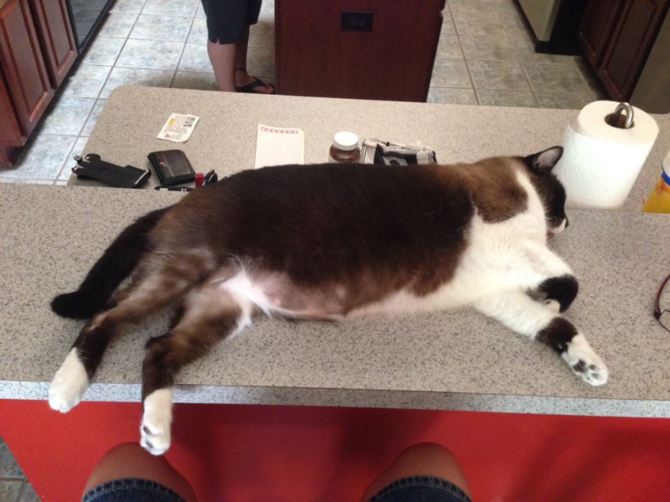
Here he is…all 18lbs of him. I could barely fit him in this picture. He’s a big boy.
Anyway….around 11PM the cat started coughing. A lot. Eventually, I could tell we were moving into projectile vomiting stage…so I gently tossed him off the bed and let him up chuck. Great….start the day with the dog barfing, end the day with the cat barfing. Nice.
So I had to wake up from my nap, take care of the cat mess and then go back to bed! I had every intention of getting up early this morning and doing a long hike. But alas…sleeping just felt like the right thing to do. So, when the alarm went off at 6AM, I turned it off.
All this to say that in no way do I feel guilty about not getting up this morning and walking. There are some days you need to listen to your body and your head and take a down day. Currently I feel really rested. No headache which is another plus. So, I’ll plan on shooting tomorrow and get out there and hike.
The other frustration I have at the moment is after 4 weeks of walking, I’m not really seeing a difference. I’ve done some research and I may need to try to shoot for walking 3 miles everyday instead of every other day. I’ve also read that it can take up to 3 months for the body to switch over. That’s okay…at this point, I have to remind myself that as long as I’m getting out there and putting in the miles, that’s all that counts at this stage. It’s about building up consistency at this point, and getting through each day.
Hope all of you had a great 4th….as for me….I’m off to the pool to lounge, eat and drink, and tomorrow I’ll hike!
When I started this about a month ago, I set a very simple goal for myself. Reach 50 miles. That’s it. That’s all I had to do. I didn’t say “walk every day” or “walk every other day” or put myself on some regimented schedule. I simply needed to hike 50 miles.
As of today, I’m little under 2 miles from my goal.
So…how do I feel?
Well, I find I’m starting to eat better. I’m not eating as much. It could be the heat of this Texas summer. I’m down to one (1) Diet Dr. Pepper a week. A WEEK! This from the woman who would down a six pack a day!
I’ve enjoyed doing this and my hope is to keep it going. Eventually, I’ll get in a weekend hike…maybe…I got a long way to go!
I’m running out of imaginative titles…anyway.
Yesterday I hiked at 4:30PM. Who’s freakin’ idea is this? Oh yeah..mine. Yay me.
Yesterday it was 96F with 40% humidity. Luckily I had breezes off of Lake Lewisville…but it still didn’t help. Toward the end, I really wanted to curl up in the brush and die.
I tried out new gear. After a trip to Academy where I dropped about $300, I came home with new compression shorts, new loose summer short sleeve shirts (all BCG; Academy brand), a couple of Magellan shorts, a light weight pair of hiking socks, a Columbia “Omni Freeze Zero” shirt, and a new 3L hydration pack (also BCG).
The socks, Thorlos, rocked it. While I haven’t gotten blisters, I do have some blister/callus type build up on my little toes and my feet just feel like crap after a hike. These socks seemed to help…even in this extreme heat. I had also picked up some Body Glide at Academy….
Body Glide….sounds like “personal lubricant” to me for those nights you want to make sexies with your mate…but that’s really what it is…except it’s purpose is to put it on your feet to help protect against blisters. Runners use it and I figured it should work for hiking as well. Hopefully a combination of the two is what did the trick.
Now…let’s move on to that $40.00 Columbia “Omni Freeze Zero” shirt. I didn’t get the sales spiel from the girl at Academy…but supposedly it’s supposed to turn cold when you sweat.
Maybe I’m not sweating?
My back was “cold”, but I couldn’t tell if that was the shirt or the cold water in my hydration pack. The rest of me, upper arms, chest, stomach felt as hot as ever.
Guess I’ll need to do some research…maybe I need to wet the shirt? I’ll report back when I find out. But for now….keep your $40.00. Or spend it and by 2 or 3 BCG shirts for the same price.
It was so hot yesterday, there wasn’t much to report from the trail. I think I saw one bunny. That was it It was so hot even the snakes and rabbits pretty much said “screw this”. I didn’t see many people out either. Maybe I’m the crazy one being out at that time of day.
I need to remember to start taking the binoculars with me…I’ve come across a lot of interesting birds…none that I’ve seen well enough to even try and begin to guess what they are.
Anyway…here’s the tape. I’ve broke 40 miles with this one! Another 10 and I hit my 50 and I have to figure out my next goal…
Miles: 3.21
Time: 58:52
Min/MI: 18:21
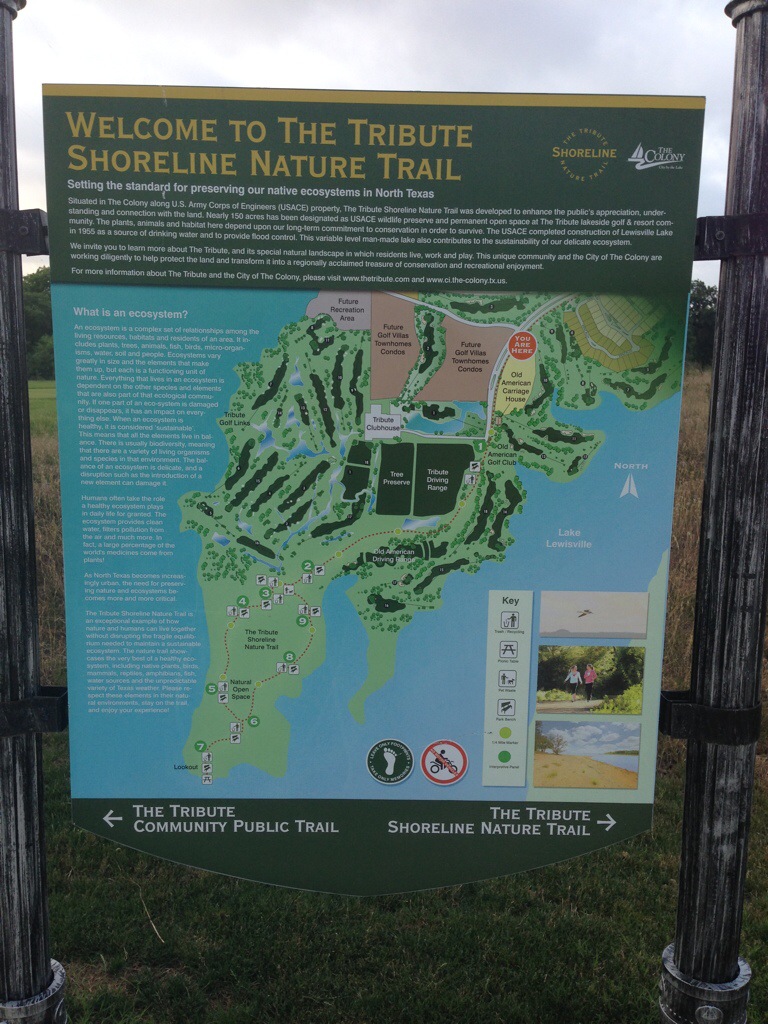
Decided that I would check out my second, hiking area….The Tribute Shoreline Nature Trail!
This is a newer trail. Just opened earlier this year. It’s about a 3 mile hike….but I turned it into 7.25 miles by doing some of the loops twice. Remember, if you hike the other direction you get a totally different perspective!
The day was perfect for hiking. 77F and windy. Humidity was at 85%, but the winds kept the air moving so it was quite pleasant.
The trailhead for the trail is off of Lebanon and FM423. Head toward The Tribute and you’ll see signs pointing you to the trail head. Nice thing is there’s a shared bathroom at this location. You have to share with the golfers.
You hike from here about a mile before you’re officially on the trail. From there for about .75 miles you’re sharing the path with golf carts. There’s plenty of signs letting the golfers know to what out for foot/bike traffic and everyone seemed okay with that arraignment.
The trail follows along and takes you to Hole 1 and beyond that the driving range of the Old American Golf Course. Once you get past the practice area, you’re off on your own.
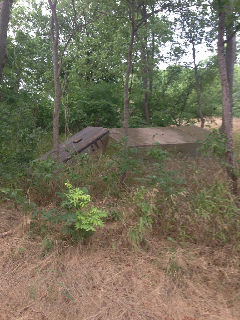
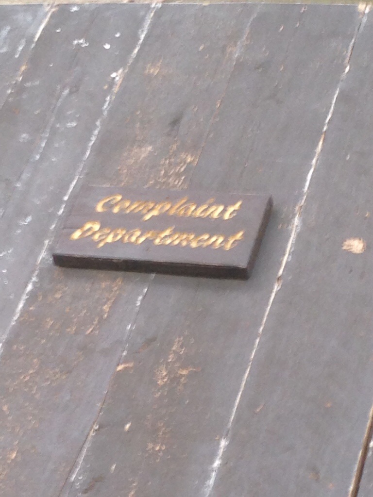
Came across this old storm shelter. It was nice that they labeled this “Complaint Department”.
As I walked along the trail I had the privilege of getting to observe golf balls in their natural habitat. You have to sneak up on them to get a picture but they are pretty amazing.

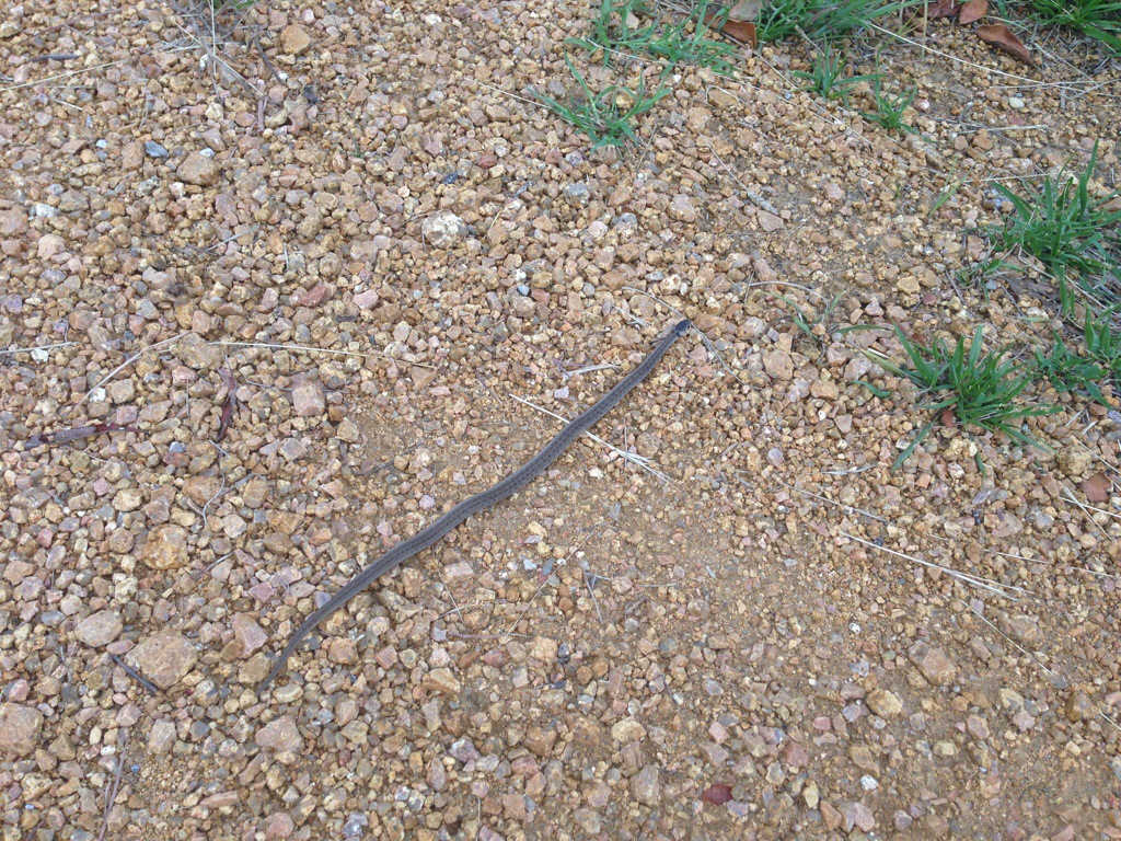
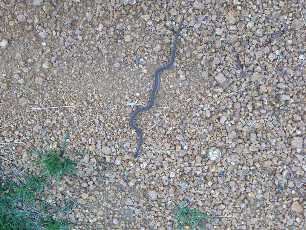
As I walked along, just past the driving range, I saw what looked like a really straight stick. Until I realized most sticks don’t have heads and tails. I gently touched him and discovered that yes….I had come across a baby Texas Rat Snake! I take this as a good sign since according to the Chinese I was born in the year of the Snake.
I like this trail because you have a wide path through woods. I mean seriously how can you not feel good hiking along this path?
Lots of wildlife out this direction. The woods are pretty dense which I like. I saw about 6 rabbits, several squirrels, one painted bunting, one hummingbird, tons of cardinals, and other song birds. With it being overcast it was just a great day to be out on the trail.
This would be a good practice trail; except being The Tribute the trail closes at 6pm. While I try to be out and back by that time on a weeknight, I don’t like being rushed.
And here’s the tale of the tape:
Miles: 7.25
Time: 2:23:32
Min/Mil: 19:48
Calories: 934
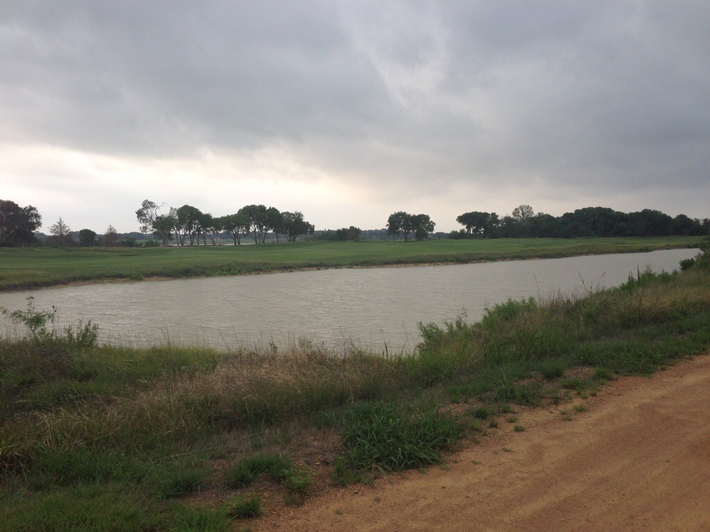
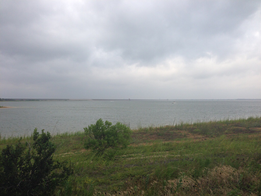
More pictures of the greens and Lake Lewisville.

Recent Comments