Trail Review: Lake Ray Roberts Greenbelt Corridor Trial: July 13, 2014
Luckily I have friends in real life who actually read this and drop me tidbits about hidden gems. This is one of those. My thanks go out to my Work Husband – JP who turned me onto this area!
Who knew that just north of Dallas, is nearly 1500 acres of remaining green! This is all part of Lake Ray Roberts State Park, but man was it worth checking out!
Ray Roberts Lake State Park
First…let’s talk directions. If you’re heading north on the Dallas North Tollway, go like you’re going to southern Oklahoma and turn left on Hwy. 380. You’ll effectively be heading into Denton. You’ll pass a ton of stuff such as the Savannah Resort Living Community that looks like it could be the backdrop of your favorite Stepford Wives movie. You’ll eventually see the turn off for Hwy. 377 North to Pilot Point….do not take 377; but instead know that about 2.06 miles later, on your right you’ll see a sign for “Greenbelt Corridor”. You’ll find a parking lot here and some restrooms but that’s it. You’re going to need to pack in plenty of water for this hike as there are no water sources on the trail. Yes…it follows the East Fork of the Trinity…but do you really want to drink that? I didn’t think so.
Anyway…once you park, you pays your money. It’s $7.00. Quick whining…it’s damn well worth it. It’s better than the crappy 6 pack of beer you bought last night…so you will pay your money and you will like it!
As for me…well…I had read it was $3.00…took $5.00 and then felt guilty as I filled out the “honor form” and promised I’d pay more next week for being a dolt. Hopefully someone got a laugh out of that. I did today sign up for the Texas State Parks Pass…so at least I followed through there.
You have two options of trails. One is a caliche trail which all the hikers, runners and bikers use and you have the equestrian trail. I decided to stick with the caliche since I needed to get a lay of the land and this was my first hike and all.
I grabbed my day pack and got everything situated. The hike between 380 and the FM 428 is about 6.5 miles…one way. So little over 12 miles if you do an out and back and that’s what I had my heart set on doing. I started just a little before 7:00am. I made sure to carry about 3 liters of water (damn water is heavy) and an extra bottle of Ozarka for when I stopped for lunch. And we’re off!

Tranquility…
I was not disappointed. This is old growth. There are trees here that are so big around, I cannot get my arms around them! The woods are dense, yet alive with all manner of tree frogs and birds as the day was getting started. I can’t tell you how long it’s been since I’ve heard tree frogs like that!
This was the start of the hike…seriously…it just got better from here!
You cross a couple of utility right of ways…the first one for electric and the second one is rail road. I can only imagine what it must sound like to stand under that trestle when the train is going over.
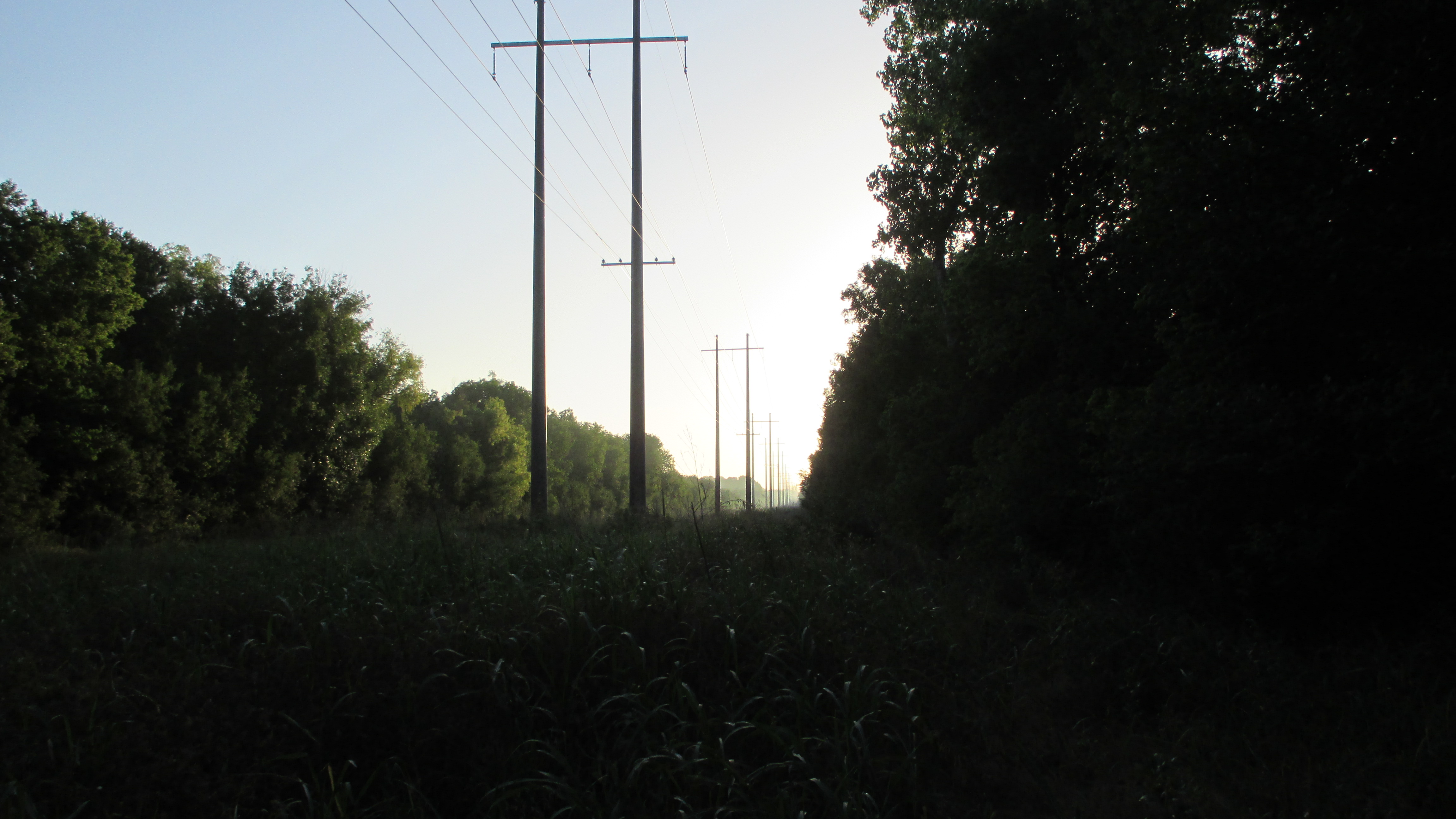
Utility Right of Way
The path is pretty easy it’s just really long. As I’ve mentioned in previous posts, I don’t listen to music or use ear buds when I’m hiking. There’s too much stuff you miss out on doing that.
For instance, as I was walking, I heard an odd crack of a branch. I stopped and about 100 yards off I saw a young buck just starting to get in his antlers move through the woods….he stopped for a minute and continued on closely followed by a doe. I realized as I had stopped that while I had put on sunscreen, I had failed to douse myself with inset repellent and the mosquitoes were looking for breakfast and I was prime candidate #1. So I took off my pack and sprayed myself down. I was hoping I would out walk them the rest of the way!
A little further something in my “wilderness” sense told me to stop. Glad I did. I was greeted by a deer and her fawn. The deer stood and stared at me a bit. She was about 20 yards from me…she then slowly turned around and continued on her way, very much unconcerned with me. That’s when her fawn wanted to come up and take a look at me and see what all the fuss was about!
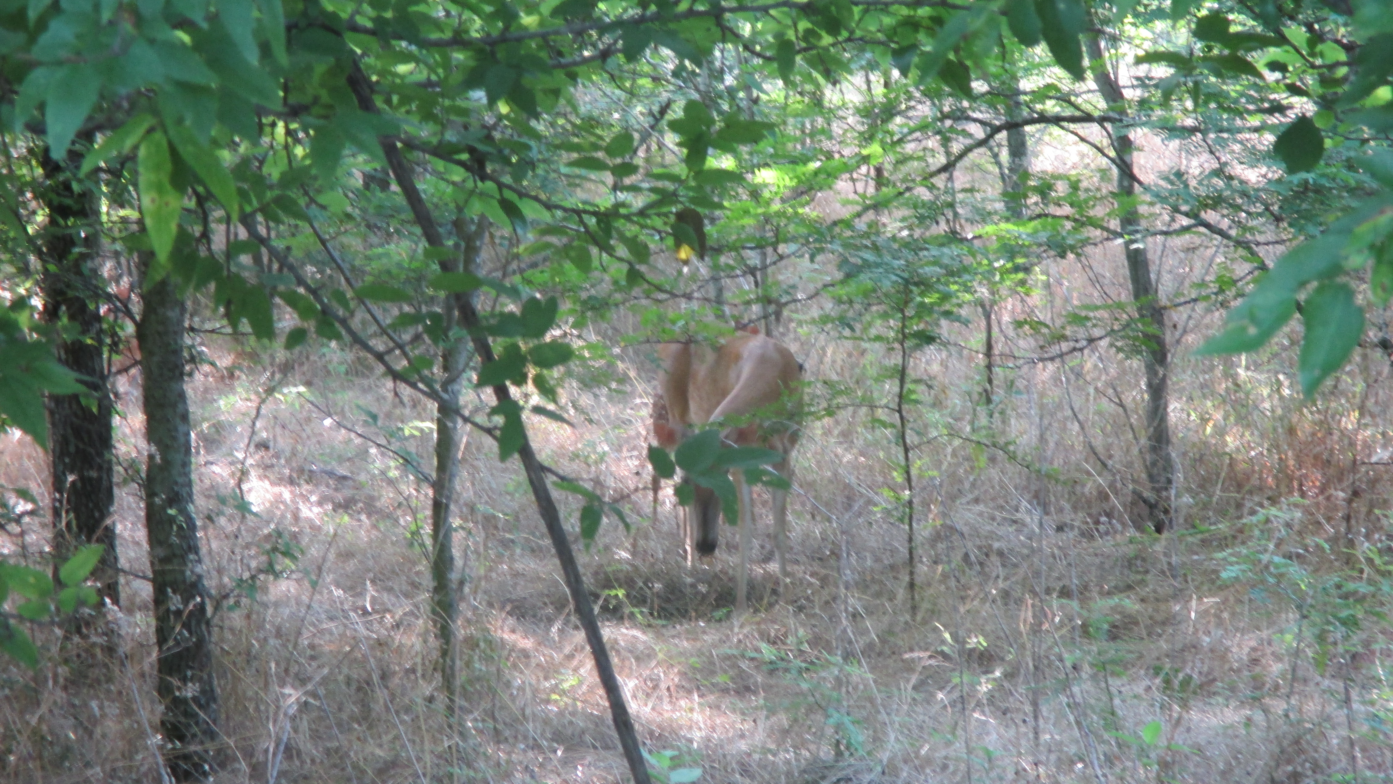
Momma

Baby
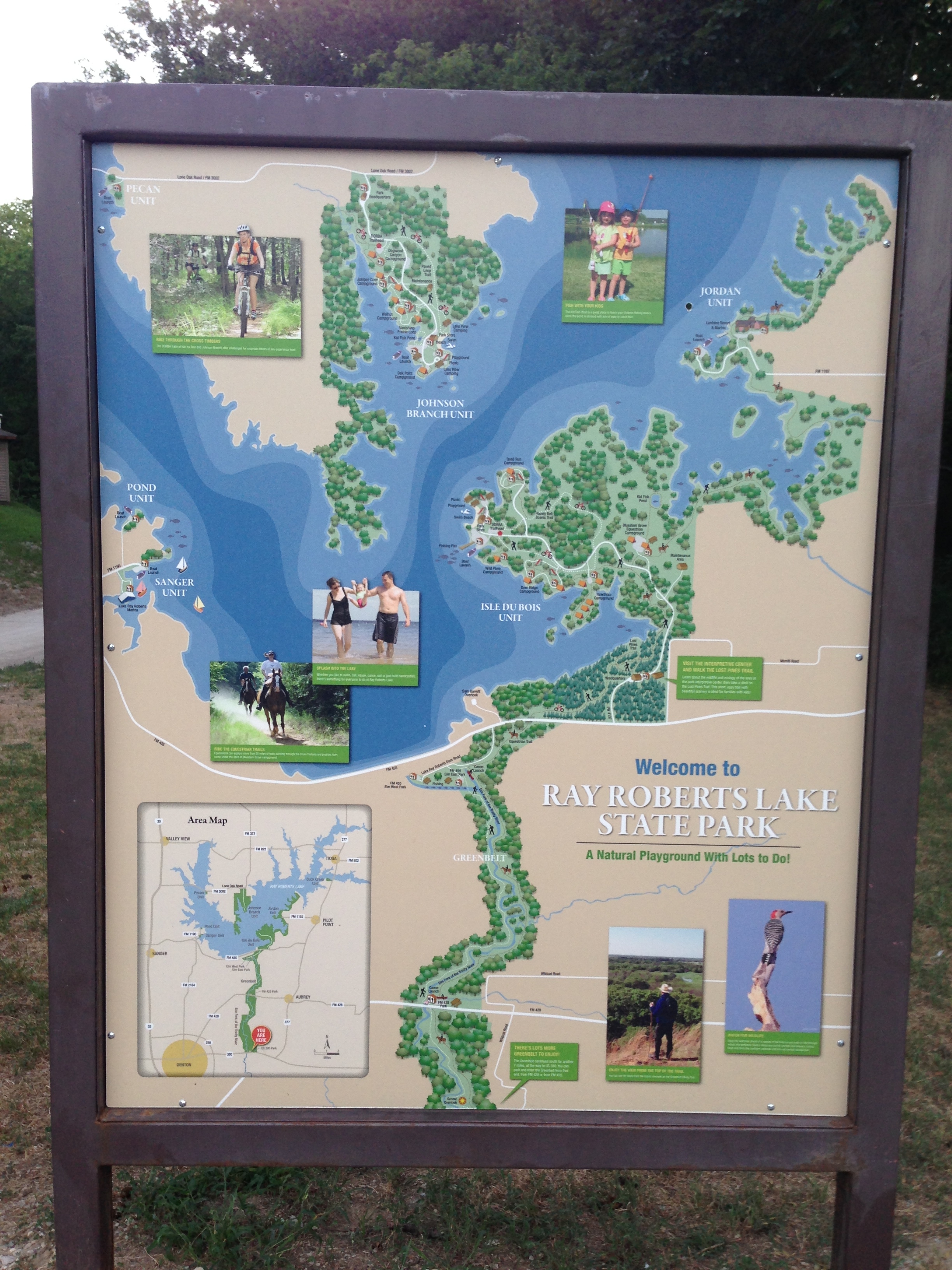
Probably one of the best site’s I have found that runs through all the different points on the trail is the one at Trail Map of Greenbelt Corridor in Ray Roberts Lake State Park.
I finally arrived at the Ray Roberts Lake State Park there off of FM 428. They have great modern restrooms, drinking fountains, and plenty of picnic tables to sit and rest. I had my lunch glad that I had brought a bottle of Ozarka vs. having to sip water from my hydration pack. When you’re thirsty like that you just want to guzzle. I took about a 30 minute break and started on my way back. I decided to start back on the equestrian trail. Not sure why…there were TONS of grasshoppers everywhere bouncing off of me…not to mention I was walking through a patch of recently mowed Johnson grass. As I got to the first tree line I startled another deer. But this time she had two fawns that she rustled up out of the grass and had them follower her deeper into the woods away from the stranger who had suddenly disrupted their late morning siesta! I decided then and there that the next time I hike this trail (which will be this weekend) I think I’m going to hike the equestrian trail. During the hike I saw a hill that must have really great views of the area. Every map I saw talked about the “scenic overlook” but I’ll be damned if I ever saw the path for it. However, upon further inspection I realized I could easily get to it via the equestrian trail.
Other than that I saw the usual woodpeckers and cardinals. I got a quick glimpse of a blue bird and a really big lizard up on a tree. Tons of dragon flies of all ages.
I finally got back to 380 around 11:45AM. This time I didn’t pause Runkeeper every time I stopped. I wasn’t really worried about pace…I really wanted to experience this trail and enjoy this hidden treasure. Here’s some pictures from the hike and of course the numbers!
Miles: 12.46
Time: 4:16:34
Min/Mil: 20:37

First Bridge

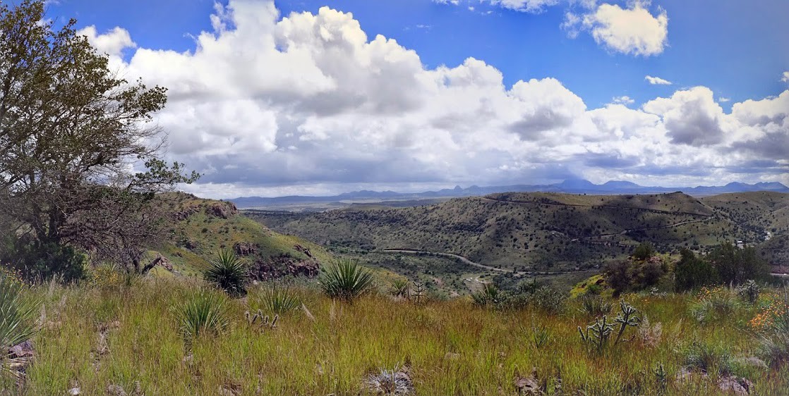
Scenic Overlook….from the bottom
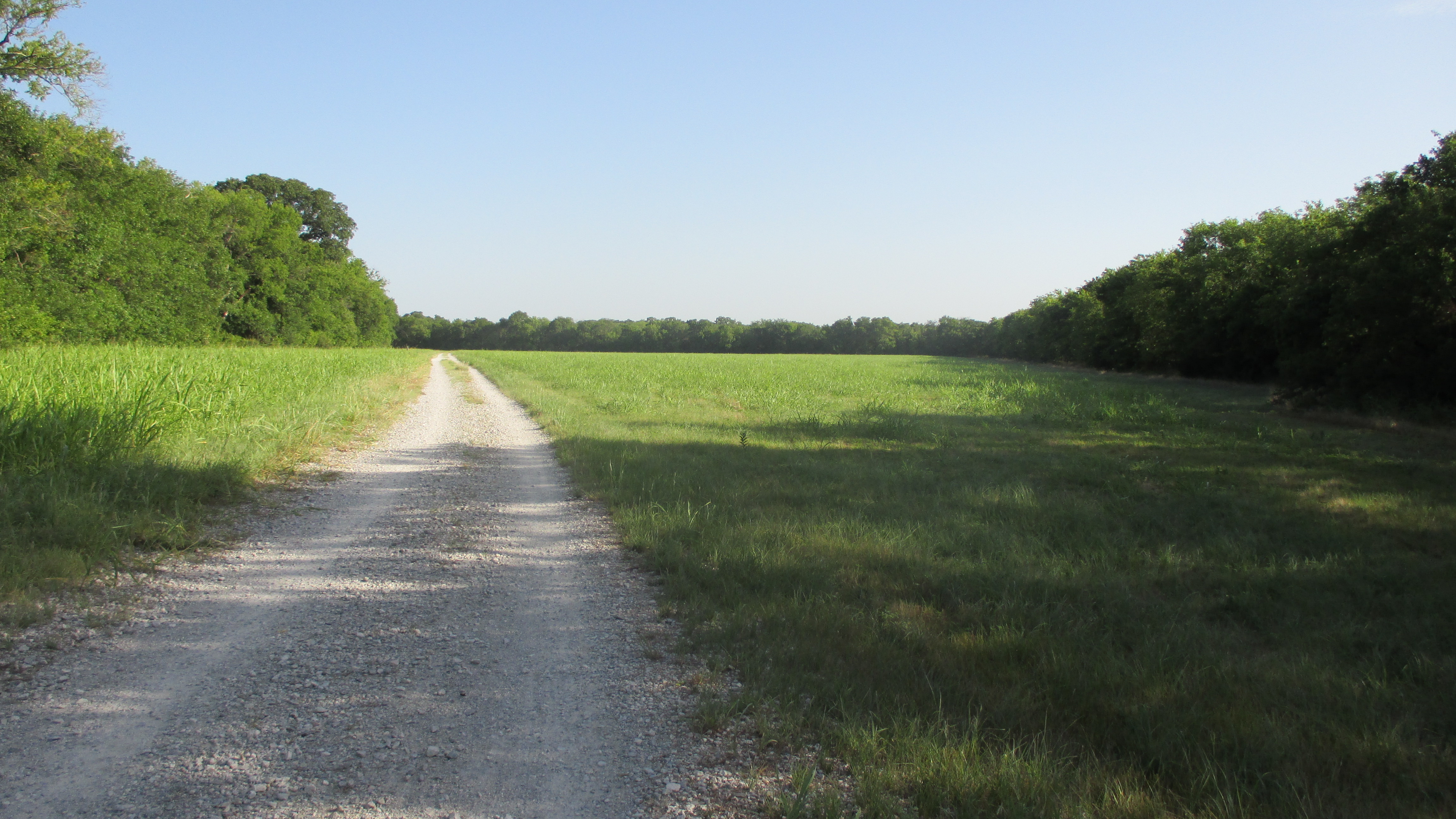
Meadow
And finally…probably my favorite picture…I love the sun coming through the tree canopy!
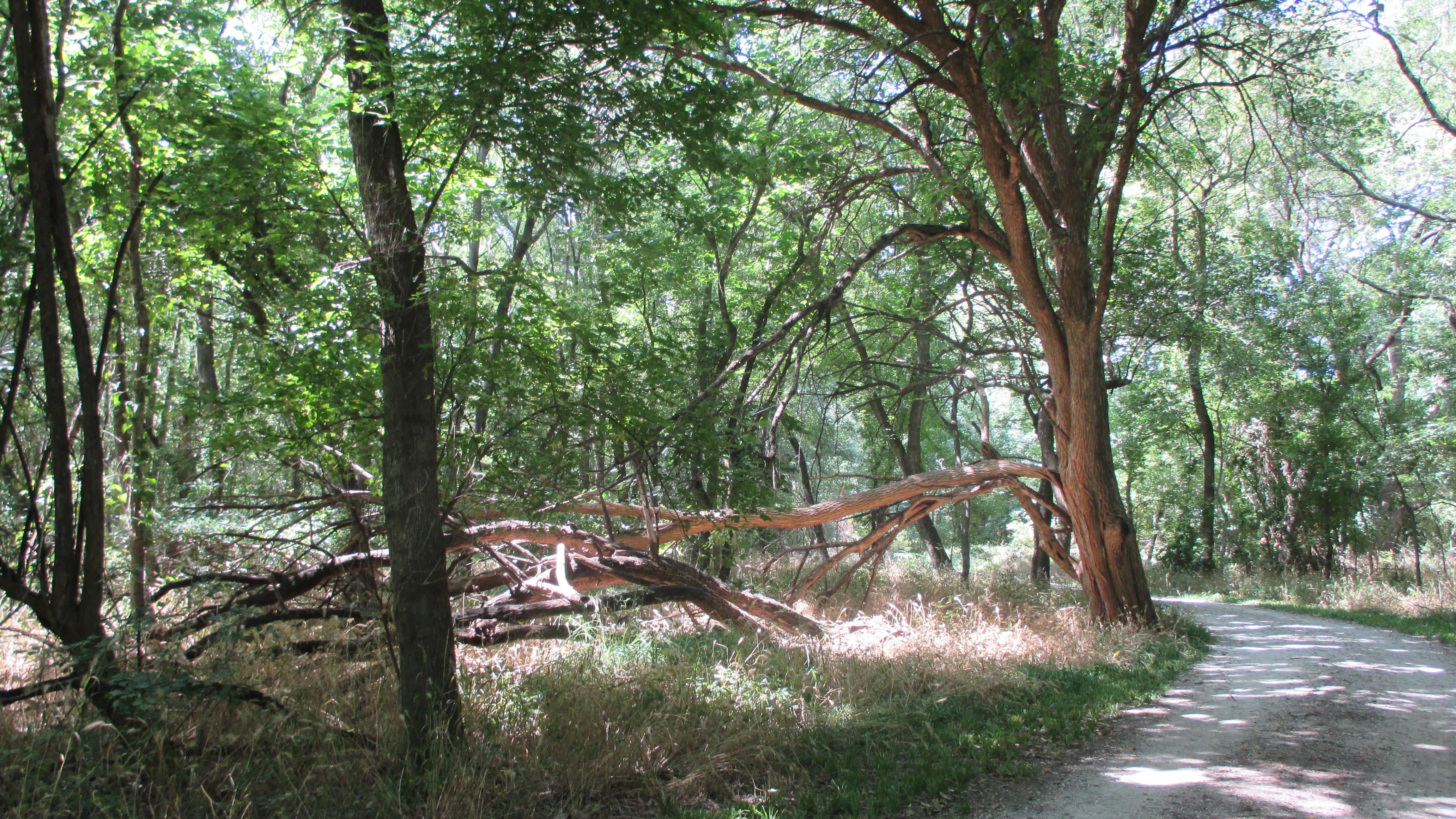
Tree Canopy

Recent Comments